Explore
Best for
124 results
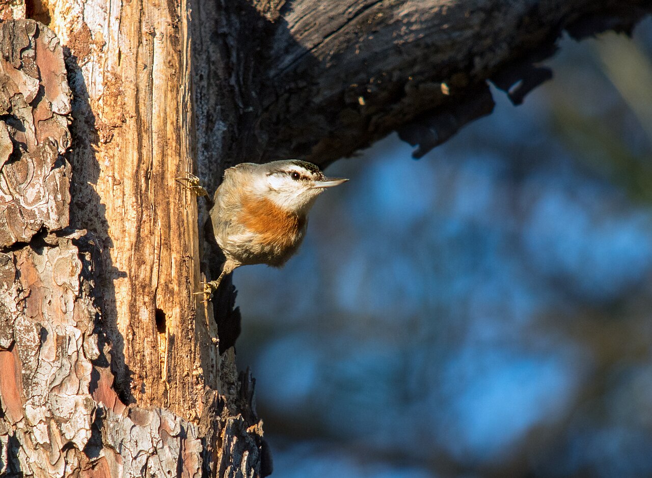
Hiking · Achladeri, eastern Gulf of Kalloni
Achladeri Pine Forest
Mature Turkish pine forest on the eastern shore of the Gulf of Kalloni around the hamlet of Achladeri. It is the classic Lesbos site for Krüper's Nuthatch, a pine-specialist bird with a very restricted world range. The Achladeri marsh, the Vouvaris river mouth and the Early Christian basilica of Achladeri lie within a few kilometres.
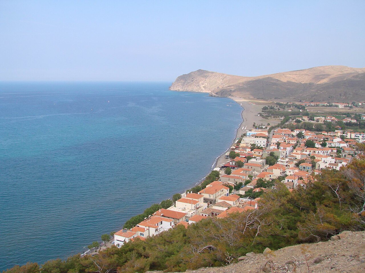
Ancient sites · Skala Eresou (west Lesbos)
Acropolis of Eresos (Vigla Hill)
The naturally fortified hill above the south-east side of Skala Eresou, called Mastos in antiquity and Vigla today, which carried the acropolis of ancient Eresos. Sections of the ancient circuit wall survive near the foot of the hill, together with the ruins of one round and one later rectangular tower and a cistern from the 14th-century Genoese castle that stood here until the Ottoman conquest of 1462.
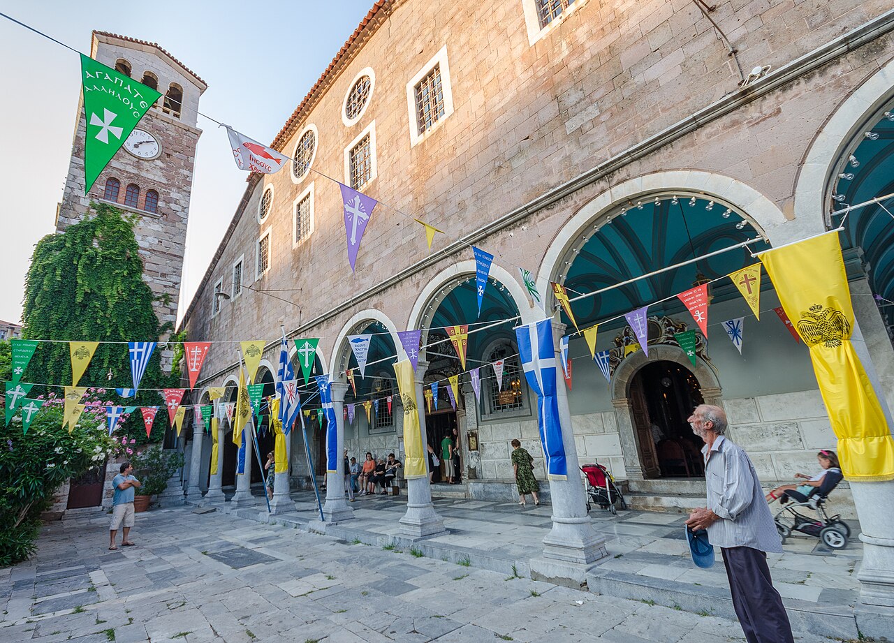
Villages & views · Mount Olympos (central-south Lesbos)
Agiasos
A large semi-mountainous village at about 460 m on the slopes of Mount Olympos, officially protected as a traditional settlement. It is built in tight stone lanes around the church of the Dormition of the Theotokos, and is known for woodcarving, pottery and its old kafeneia; the 15 August festival is the biggest on the island.
Eat & drink · Agiasos
Agiasos Kafeneia
Agiasos, a stone-built hill town on the north slope of Mount Olympos, keeps a run of old-style kafeneia along its cobbled lanes; it is the traditional place on Lesbos for ouzo with meze in the shade rather than on a beachfront. The Chestnut Trail and the Agiasos-Asomatos walking route start nearby.
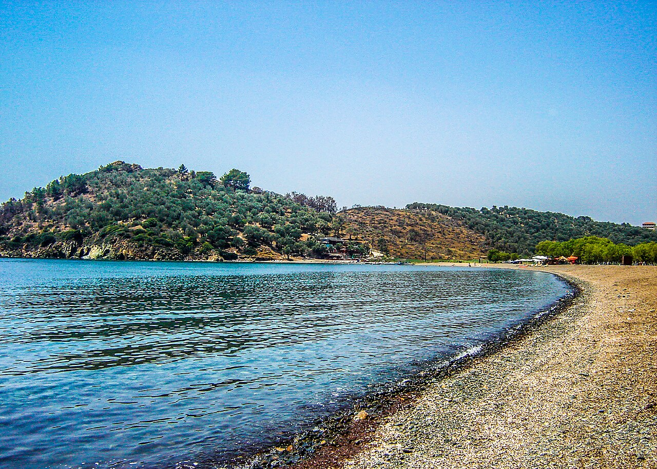
Beaches · Agios Ermogenis, south of Mytilene
Agios Ermogenis Beach
Small sandy cove on the Mytilene peninsula south of the town, mapped in OSM with a sand surface. Popular with residents of Mytilene as the nearest good swimming beach, alongside neighbouring Charamida.
Churches & monasteries · Anemotia (central-west Lesbos)
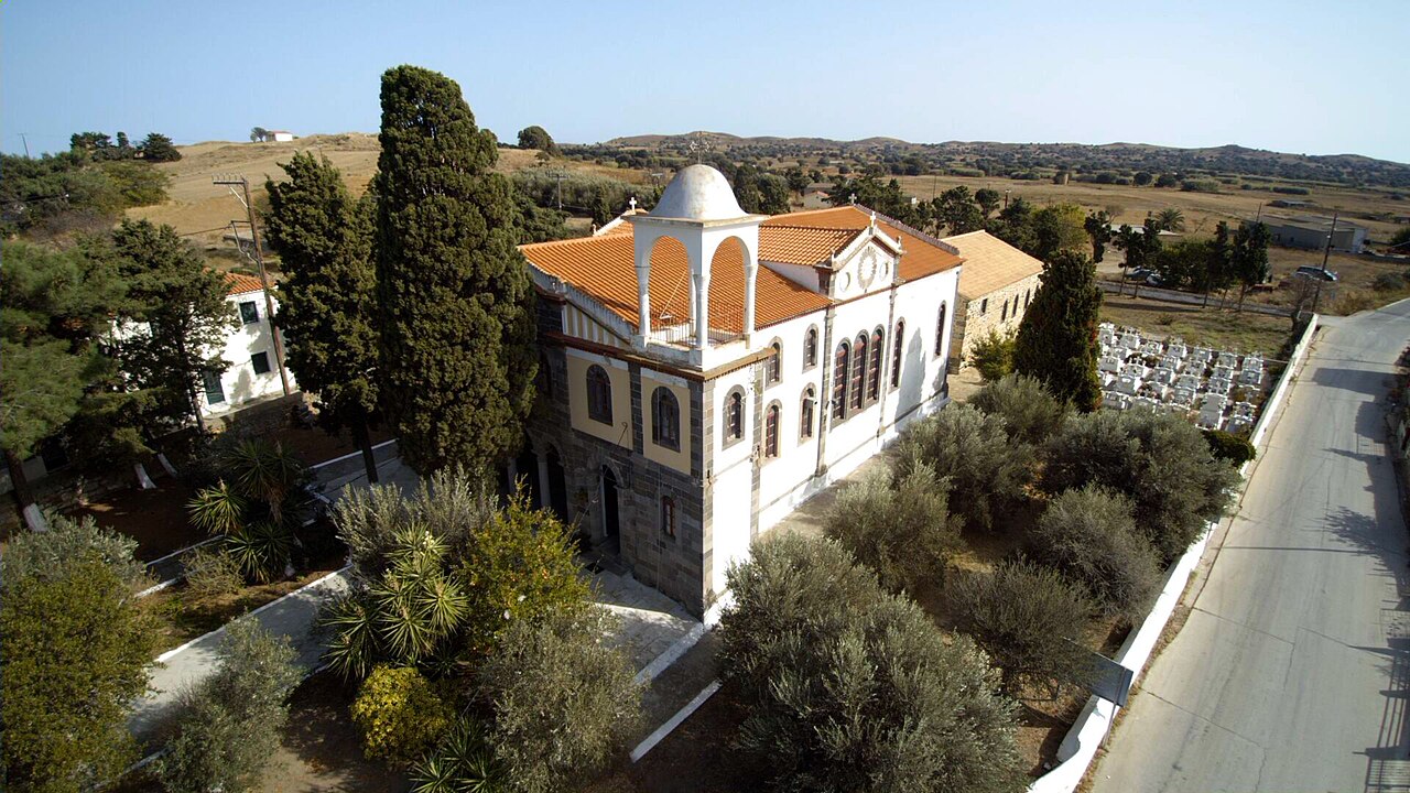
Church of Agios Georgios, Anemotia
A single-space village church with a gabled tile roof in the lower part of Anemotia, built in 1702 according to its founder's inscription and enclosed by a wall with a gate on the south side. Its painted decoration is unusual for an Orthodox church, showing the martyrdom cycle of Saint George and scenes from the Book of Revelation rather than the standard iconographic programme.
Beaches · Agios Isidoros, Plomari, southern Lesbos
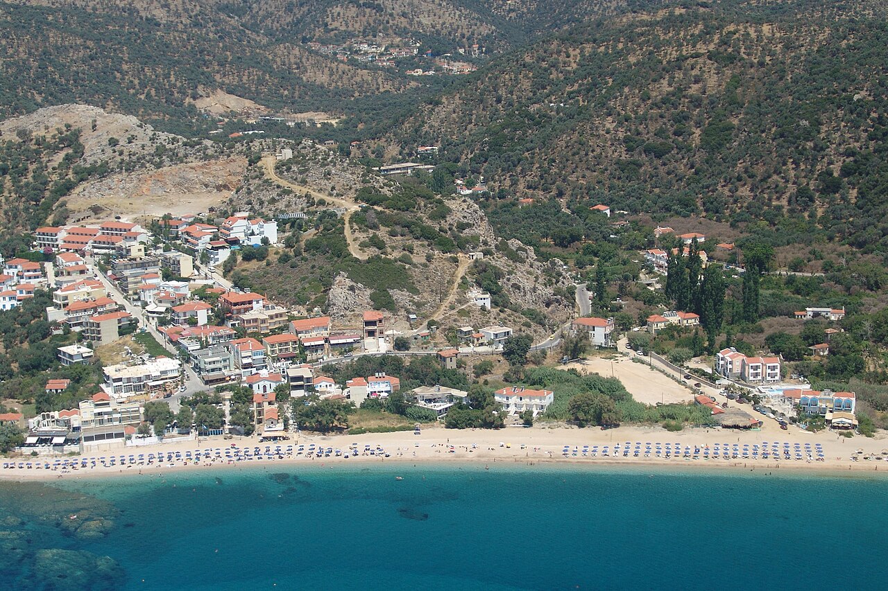
Agios Isidoros Beach
Long pebble-and-sand beach in the hamlet of the same name, roughly 3 km east of Plomari on the south coast. Mapped in OSM both as a settlement and as a beach; the strip behind it carries hotels, tavernas and beach bars.
Churches & monasteries · Mytilene
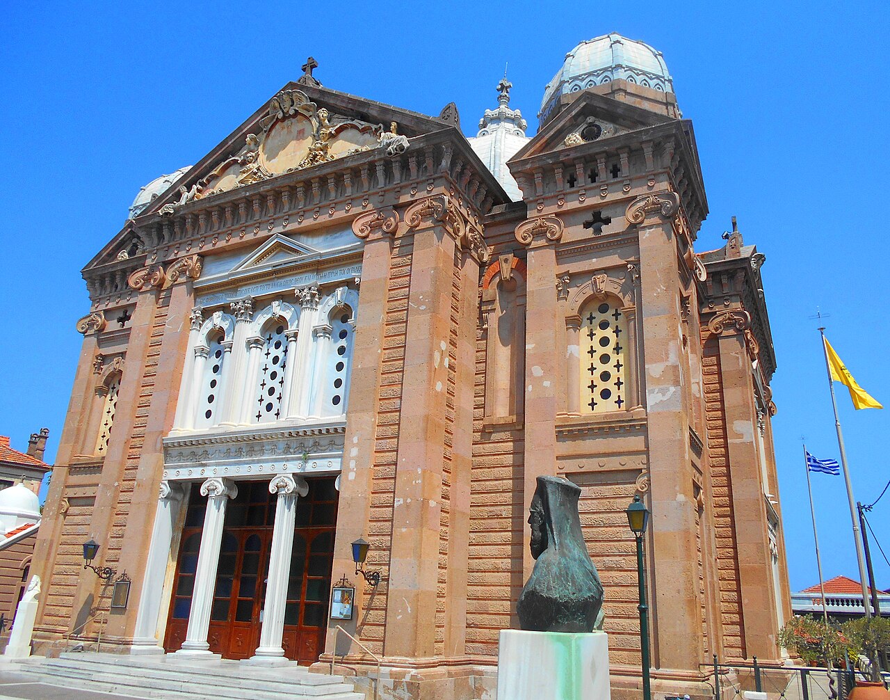
Church of Agios Therapon, Mytilene
The landmark church of the Mytilene waterfront, begun in 1850 to designs by the architect Argyris Adalis, built on a domed cross-in-circle plan with Gothic detailing on the exterior and five domes, the central one sheathed in tin. Its exterior ornamentation is by the artist Nikolaos Kessanlis and the interior woodwork by Dimitrios Kovalas; the Church History and Byzantine Museum stands on the square opposite.
Sea & diving · Molyvos harbour
Alternative Sailing (Molyvos)
Boat-rental and sailing operation with a base at Molyvos harbour, mapped in OSM as amenity=boat_rental. Sister bases are mapped at Petra and at Mytilene. No official website could be verified; contact on site at the harbour.
Sea & diving · Mytilene
Alternative Sailing (Mytilene)
Mytilene base of the same boat-rental operator, mapped in OSM beside the town's marina and passenger port. No official website could be verified.
Sea & diving · Petra
Alternative Sailing (Petra)
Petra base of the same operator, mapped in OSM on the Petra seafront near the Kavaki mooring. No official website could be verified.
Beaches · Plomari
Ammoudeli Beach
Pebble beach immediately west of Plomari town, within walking distance of the waterfront. Mapped in OSM as 'Αμμουδέλι'; a taverna of the same name sits behind it.
Beaches · Anaxos Skoutarou, north-west Lesbos
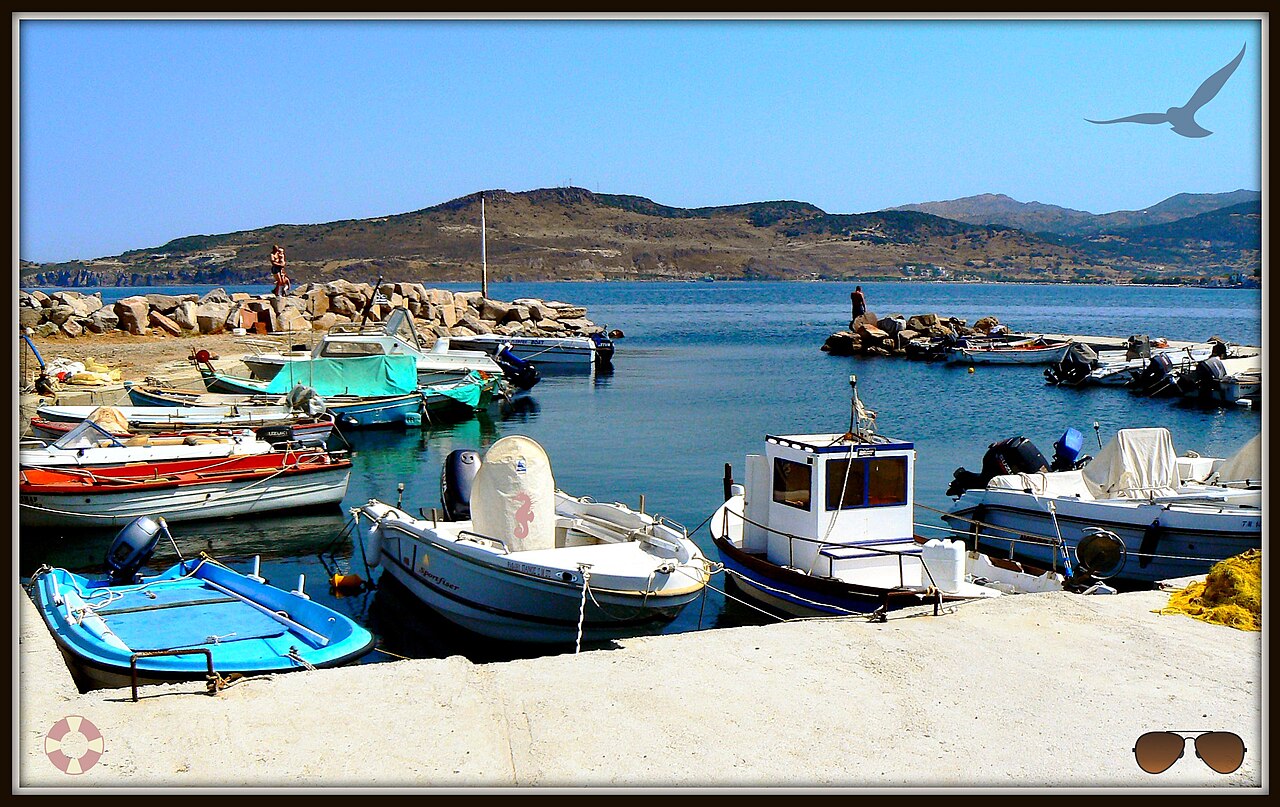
Anaxos Beach
Sheltered sandy beach in a small purpose-built resort west of Petra, mapped in OSM as 'Παραλία Άναξου'. Shallow water and a compact strip of tavernas, bars and rental apartments behind it; Molyvos castle is visible along the bay.
Ancient sites · Antissa / Gavathas (west Lesbos)
Ancient Antissa and Ovriokastro
The site of one of the ancient Aeolian cities of Lesbos, on a headland on the north-west coast near Gavathas, first settled in the Late Bronze Age. Tall walls reinforced by square towers survive along the coastal side, and a Byzantine castle known as Ovriokastro or Agioi Theodoroi, historically the island's third strongest fortress after Mytilene and Molyvos, was built over the ancient city.
Ancient sites · Molyvos / Mithymna (north Lesbos)
Ancient Mithymna
The remains of the Aeolian city that occupied the same headland as modern Molyvos, at its largest in the Archaic period and contracted to the acropolis and the Dapia area by the 4th century BC. Scattered visible remains include Hellenistic defensive walls later absorbed into the medieval castle, dock ruins in the modern harbour, a bath complex used from the 3rd century BC to the 3rd century AD, Roman aqueduct fragments from Mount Lepetymnos, and Archaic and Hellenistic-Roman cemeteries along the road to Petra.
Ancient sites · Mytilene
Ancient Theatre of Mytilene
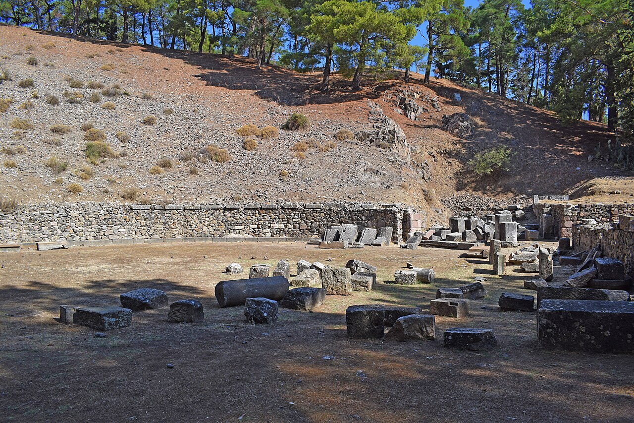
A large Hellenistic theatre cut into the volcanic rock of Agia Kyriaki hill above Mytilene, about 107 m in diameter, with a marble-clad orchestra wall and a reported capacity of around 10,000. Ancient tradition holds that Pompey used it as the model for Rome's first stone theatre; part of the building was converted into an arena in the Roman period.
Villages & views · West Lesbos
Antissa
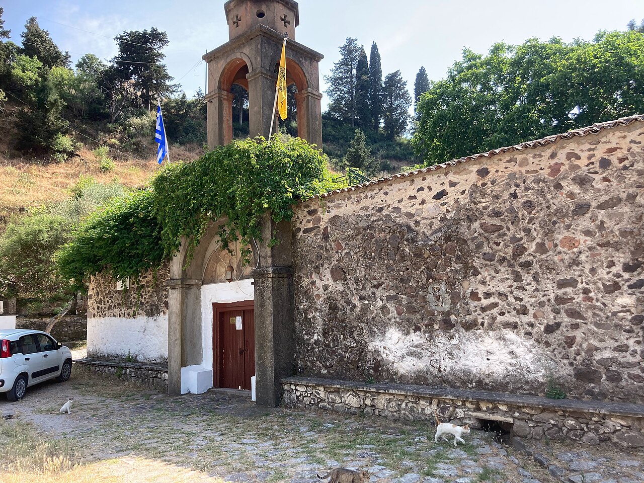
A village at 276 m in western Lesbos, 76 km from Mytilene, looking north over the Aegean towards the Turkish coast, with an economy based on stock-farming and tourism and serving as a small service centre for the west of the island. It takes its name from the ancient Aeolian city on the coast below and is the nearest base for the Perivolis monastery, Ovriokastro and the Petrified Forest parks.
Museums · Skala Eresou (west Lesbos)
Archaeological Collection of Eresos
A small state collection at Skala Eresou, housed since 2012 in a purpose-built stone building with an adjoining partly open-air courtyard. The thematic displays cover ancient Eresos from the Late Helladic period to Early Christian times, with everyday pottery, votive reliefs and figurines of deities, burial finds including grave reliefs and a clay sarcophagus, and public inscriptions.
Museums · Mytilene
Archaeological Museum of Mytilene - New Wing
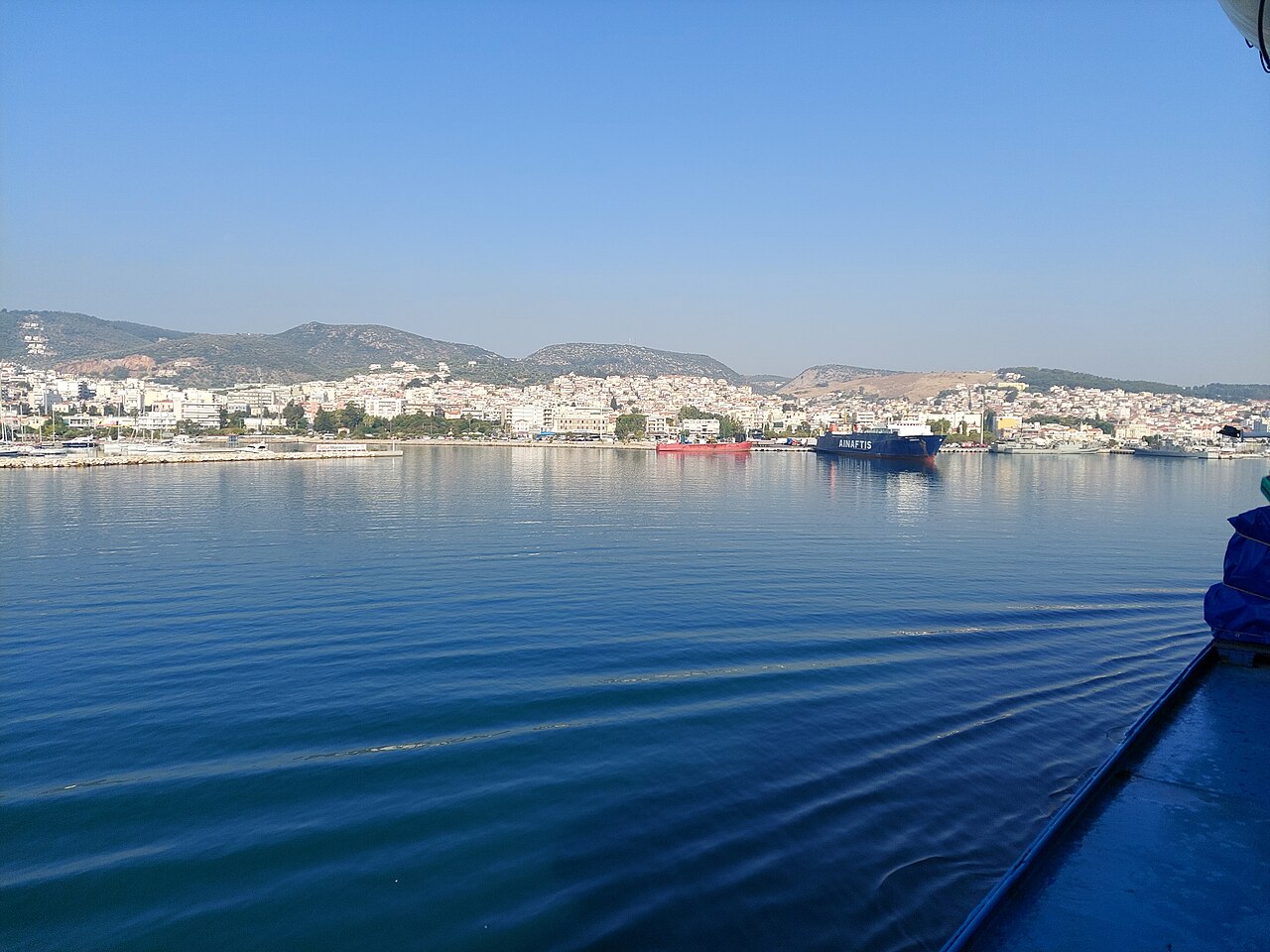
Opened in 1999 on 8th Noemvriou Street in the Kioski district below the castle, this purpose-built museum covers Hellenistic and Roman Lesbos in six exhibition spaces. Highlights are the mosaic floors and sculpture from Roman houses of Mytilene, including the mosaics illustrating scenes from Menander; the building also holds ceramics and metals conservation laboratories and runs education programmes.
Museums · Mytilene
Archaeological Museum of Mytilene - Old Wing
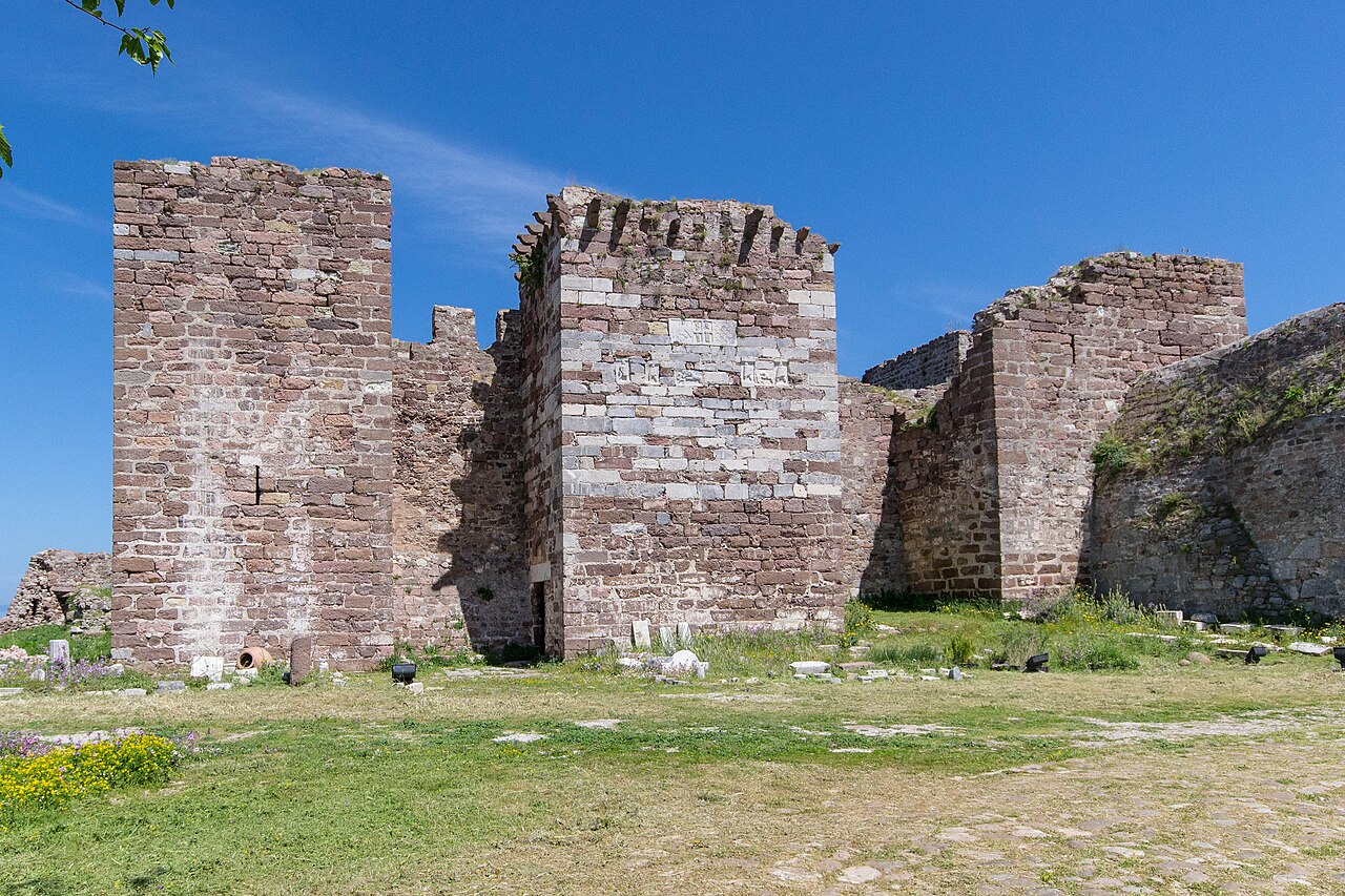
The older of the museum's two buildings, an eclectic-style mansion built in 1912 for the Vournazos family at 7 Argyri Eftalioti Street. Its first floor shows Late Neolithic and Bronze Age finds in three halls, the second floor covers the 10th to 4th centuries BC across six halls, and the outbuilding displays architectural members and monumental sculpture.
Practical · Mytilene port to Ayvalık, Turkey
Mytilene-Ayvalık Ferry
Cross-border ferry between Mytilene and Ayvalık in Turkey, operated by Turyol, running in both directions and carrying vehicles as well as foot passengers. Schedules and fares are published on the operator's timetable pages and vary by season. A passport is required and Turkish visa rules apply by nationality.
Eat & drink · Plomari
Barbayanni Ouzo Museum
Museum attached to the Barbayanni (Varvayannis) distillery in Plomari, a family firm founded in 1860 by Efstathios Varvayannis and now producing five ouzo varieties in small copper stills. The museum sits next to the modern plant and covers the family's distilling history.
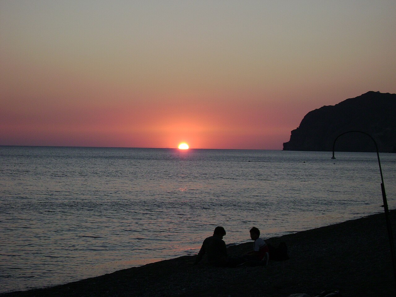
Churches & monasteries · Skala Eressou (west Lesbos)
Early Christian Basilica of Agios Andreas, Skala Eressou
A three-aisled Early Christian basilica of about 450 AD in the south-eastern part of Skala Eressou, with a narthex, a nave paved with a mosaic showing peacocks, and an inscribed semicircular apse. The ruins were uncovered in 1884-85 by monks of the Pithari monastery, and the church is named after Archbishop Andrew of Crete, who fell ill on arriving from Constantinople and died at Eresos.
Sea & diving · Skala Eressou, western Lesbos
Black Rock Dive Centre
The only dive operator on Lesbos that could be verified as trading, based at Skala Eressou. Offers guided dives, snorkelling trips, freediving, boat trips and courses from Bubble Maker through to Divemaster plus specialities (wreck, deep, night, photography). Season stated as May to October. No phone or email is published on the site.
Museums · Mytilene
Church History and Byzantine Museum of Mytilene
Founded in 1978 around a Byzantine icon collection begun in 1958, and housed in a building on Agios Therapon Square opposite the church of Agios Therapon. It displays portable icons and religious folk art from the 13th to the 20th century together with woodcarvings, vestments, manuscripts and liturgical objects.
Practical · Mytilene Airport (MJT), Kratigos
Car Hire at Mytilene Airport
Rental desks are clustered at the airport terminal, with Avis, Budget, Hertz/Thrifty, Avance and Discover all mapped in OpenStreetMap at the terminal frontage. A car is effectively necessary to reach the beaches, hot springs and birding sites, since bus service between villages is sparse.
Practical · Mytilene town waterfront
Car Hire at Mytilene Port
A second cluster of rental offices lines the Mytilene waterfront by the passenger port, useful if you arrive by ferry. OSM records Avis (08:00-21:00 daily), Europcar, Auto Union, Aeolian Rent a Car, Lesvos Rentals (tel +30 22510 37337) and RentacarLesvos among others.
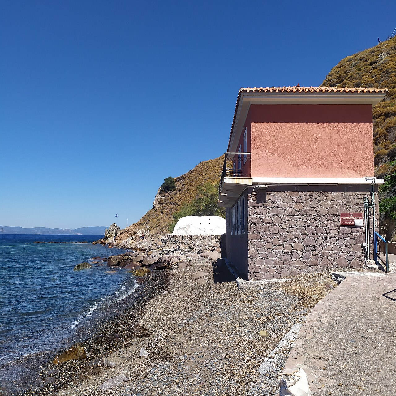
Hiking · Eftalou, near Molyvos, northern Lesbos
Eftalou Hot Springs
Small domed thermal bathhouse on the shoreline at Eftalou, about 4 km east of Molyvos, where hot mineral water emerges a few metres from the sea. There is a pebble beach and a taverna beside it, and the Agioi Anargyroi monastery just above.
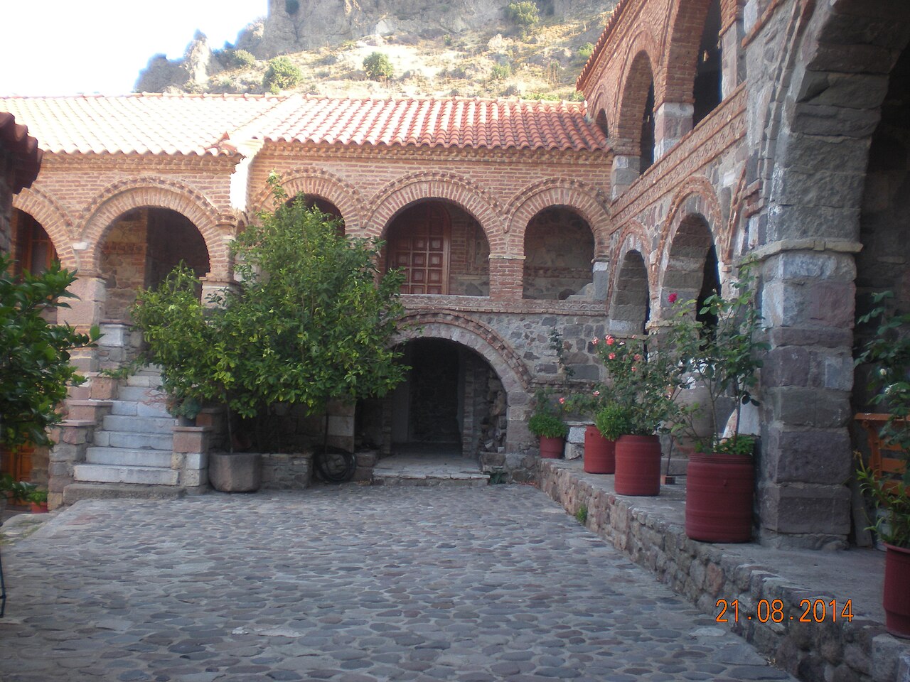
Villages & views · West Lesbos
Eresos and Skala Eressou
An inland village 89 km from Mytilene set between the hills of Troulos and Lemboras, with its beach settlement Skala Eressou about 4 km south. Eresos was the birthplace of the poet Sappho and the philosopher Theophrastus; the area holds the acropolis on Vigla hill, the Early Christian basilica of Agios Andreas and the Archaeological Collection, and Skala Eressou has a long Blue Flag beach.
Beaches · Faneromeni, near Sigri, western Lesbos
Faneromeni Beach
Remote beach on the far west coast north of Sigri, reached by an unsurfaced track past the Panagia Faneromeni chapel. Backed by the LES031 Faneromeni wetland and river mouth, which is one of the island's well-known migration watchpoints. No facilities.
Museums · Sykaminia (north Lesbos)
Folklore Museum of Sykaminia
A village museum in the stone former primary school of Sykaminia, showing looms, local costumes and a preserved classroom with its original wooden desks and blackboard. Its best-known section reassembles the study of the writer Stratis Myrivilis, who was born in the village, with his bed, bookcases, desk, typewriter, pipes and musical instruments.
Museums · Chidira (west Lesbos)
Georgios Iakovidis Digital Museum
A museum in the mountain village of Chidira dedicated to the painter Georgios Iakovidis, who was born there, presented entirely through digital projections and interactive systems rather than original canvases. Visitors can zoom into individual works, analyse details and compare them with paintings by the artist's teachers; it was created by the N. G. Papadimitriou Educational and Cultural Foundation and is described as the first digital museum in Greece.
Eat & drink · Plomari
Giannatsis Distillery
Plomari ouzo producer listed in the Greek Wikipedia register of ouzo producers, trading as Giannatsi-Kavarnos G. & Sia. The company website resolves, but no address, coordinates or visitor access could be verified.
Ancient sites · Agia Paraskevi (central Lesbos)
Early Christian Basilica of Halinadou
A three-aisled, timber-roofed Early Christian basilica with narthex and semicircular apse, dated to the second half of the 6th century by its architecture and by a coin of 587/8 AD found in the excavation. It was dug in 1937 and partly restored by Professor Anastasios Orlandos, who re-erected the Ionic colonnades; parts of the presbytery screen and the altar area survive.
Activities · Toumba, Lesbos
Horseback Riding at Toumba
Horse riding at Toumba, listed by the Lesvos Geopark among its official field activities. No operator name, coordinates, contact or pricing is published on the Geopark page, so all of those are omitted here.
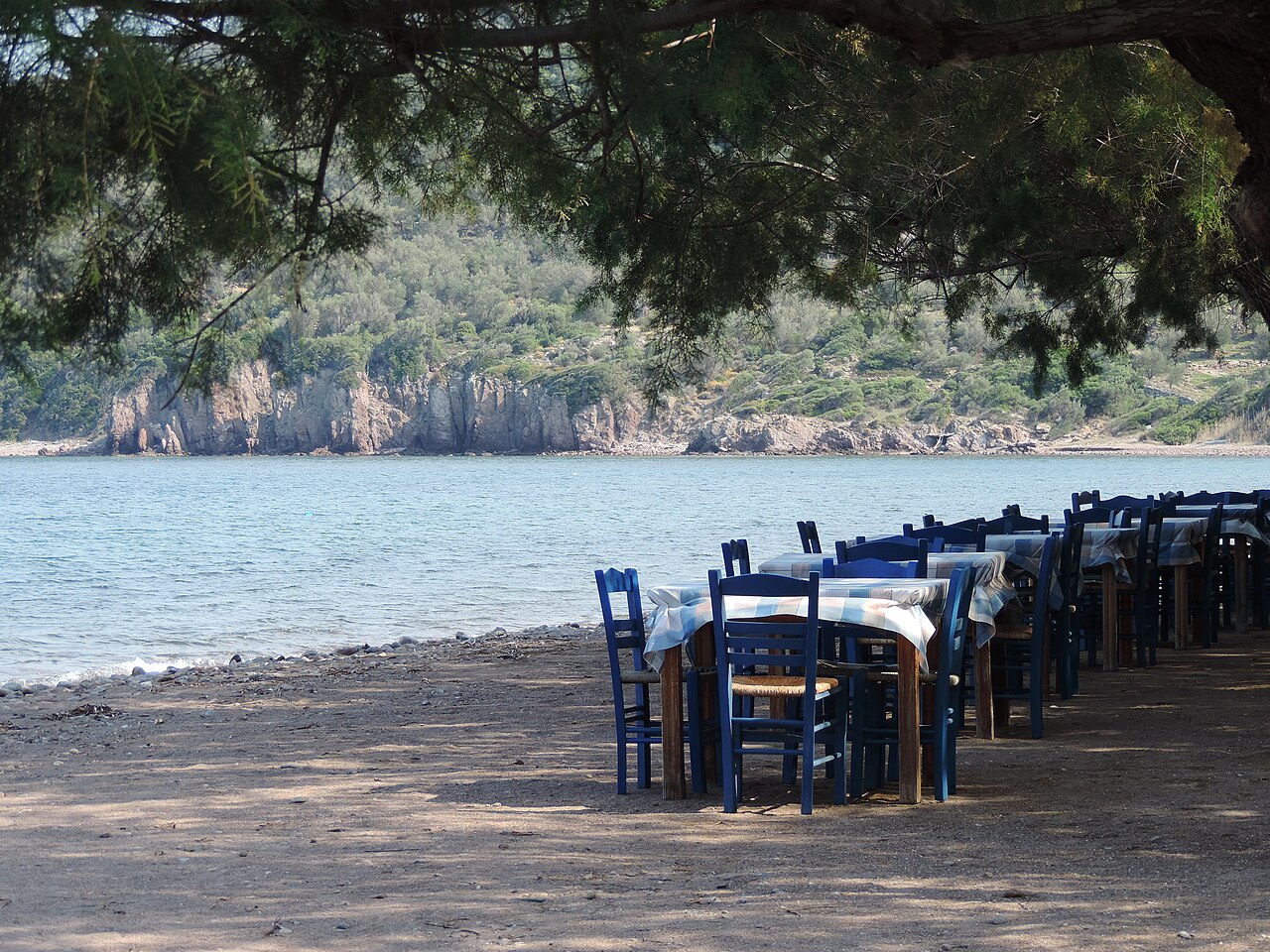
Beaches · Skala Sykaminias, northern Lesbos
Kagia Beach
Sand beach on the north coast immediately east of Skala Sykaminias, reached by a short track off the coast road. Undeveloped compared with the Molyvos–Petra side of the island.
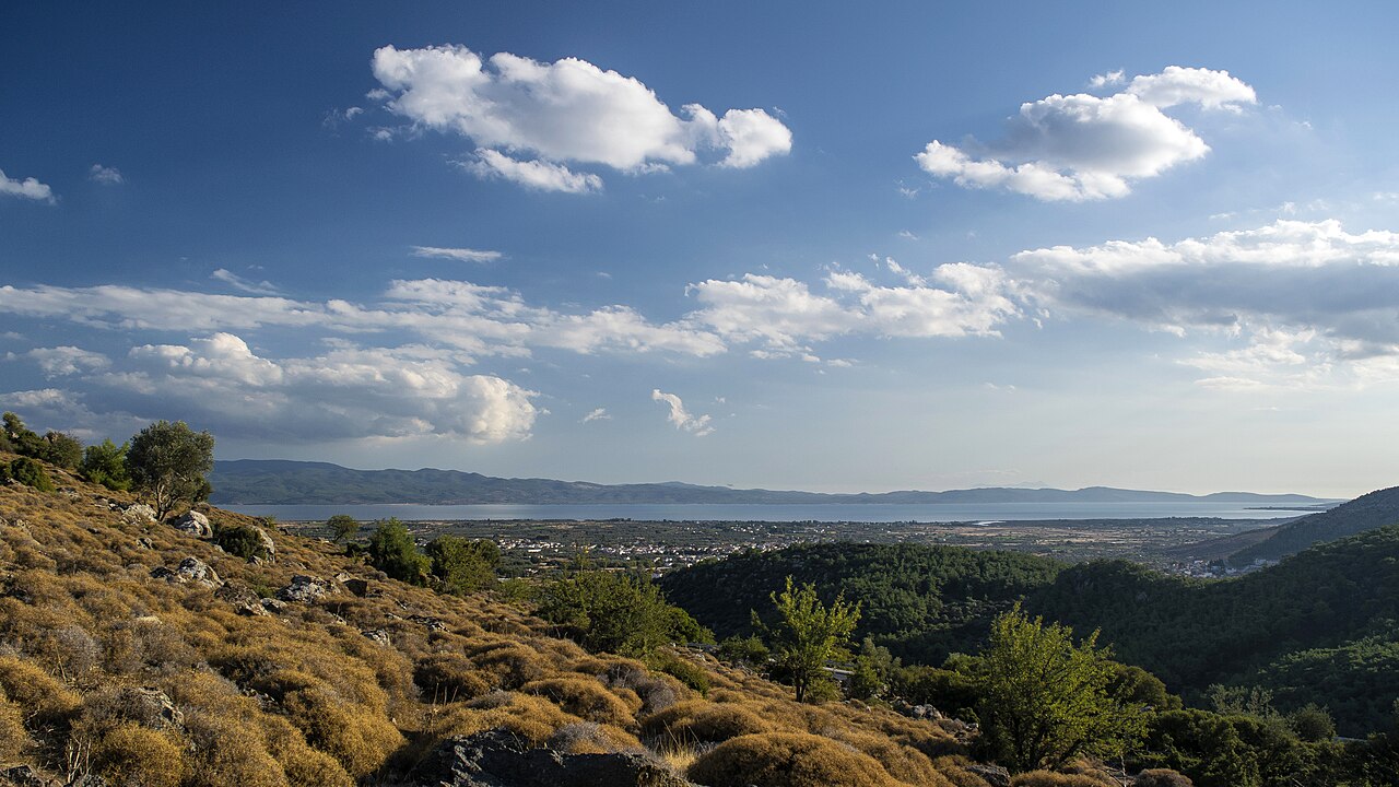
Villages & views · Central Lesbos (Gulf of Kalloni)
Kalloni
The island's second urban centre, 40 km from Mytilene on the central plain at the head of its gulf, and the main road junction of Lesbos. It is known for the sardines of the Gulf of Kalloni, and the salt pans and wetlands around Skala Kallonis - the Natura-protected lagoon sometimes called Aristotle's Lagoon - are among the best bird-watching sites in the Mediterranean; ancient Arisbe, Pyrrha and the sanctuary at Mesa lie in its district.
Hiking · Kalloni
Kalloni Environmental Information Centre
Interpretation centre for the Gulf of Kalloni wetlands, run by the Natural History Museum of the Lesvos Petrified Forest under the North Aegean Region. It holds permanent exhibitions and screenings on the gulf's biodiversity, runs field activities, and maintains the bird observation towers around the wetlands. Its portal publishes up-to-date species records per site.
Practical · Kalloni
Kalloni Health Centre
Health centre serving central and western Lesbos from Kalloni — the nearest staffed facility for visitors based around the Gulf of Kalloni, Skala Kallonis, Molyvos and Petra.
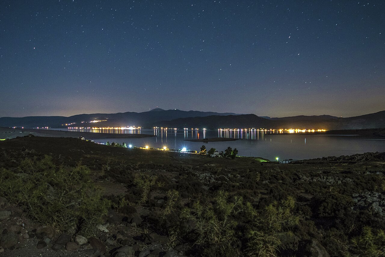
Hiking · Kalloni salt pans, Gulf of Kalloni
Kalloni Salt Pans
The working salt pans at the head of the Gulf of Kalloni are the single best-known birdwatching site on Lesbos, with greater flamingo among the regular birds. OSM maps four purpose-built hides around the pans, two of them signed as Lesvos Geopark observatories. The island as a whole has 331 recorded bird species out of 455 recorded in Greece.
Ancient sites · Agia Paraskevi (central Lesbos)
Sanctuary of Apollo Napaios at Klopedi
An Archaic sanctuary above Agia Paraskevi whose scattered trachyte architectural fragments include some of the finest known Aeolic capitals. The temple was founded in the 8th century BC on a cult site going back to the Late Bronze Age, and worship shifted from a fertility goddess to Apollo Napaios in the 7th century BC.
Practical · Mytilene, near the port
KTEL Lesvos Intercity Bus Station
The island's intercity bus operator and its Mytilene terminal, near the port. Routes connect Mytilene with Molyvos, Petra, Sigri, Skala Eressou, Kalloni, Plomari, Agiasos, Polichnitos, Vatera and around 50 further villages, plus a long-distance service to Thessaloniki. Timetables are searchable by route and date on the website; telephone +30 22510 28873. Service is much reduced at weekends and out of season.
Hiking · Mount Lepetymnos, northern Lesbos
Trails of Mount Lepetymnos
Network of waymarked footpaths on Mount Lepetymnos (968 m), the highest point of northern Lesbos, signed from the villages of the north coast. OSM records trail information boards for Lepetymnos, for Petra and a general 'Trekking Trails' board in Molyvos; the Kastelia / Agios Dimitrios area between Mithymna, Argenos and Lepetymnos is a designated nature reserve.
Practical · Mytilene (island-wide rota)
Pharmaceutical Society of Lesvos (on-duty pharmacy rota)
The professional body for the island's pharmacists, and the authoritative place to find which pharmacies are on duty (εφημερεύοντα) today across Lesvos — essential outside normal hours, when most pharmacies close. Office at Imvrou 2, Mytilene 81100; telephone +30 22510 43253. Rural clinics and village pharmacies are also mapped in OpenStreetMap.
Hiking · Lisvori, Polichnitos municipal unit, southern Lesbos
Lisvori Hot Springs
Thermal spring site between Polichnitos and Lisvori, mapped in OSM both as a public bath ('Θερμοπηγές') and as the 'Old Thermal Springs of Lisvori'. Simple, largely unrestored facilities in open country near the Almyropotamos stream.
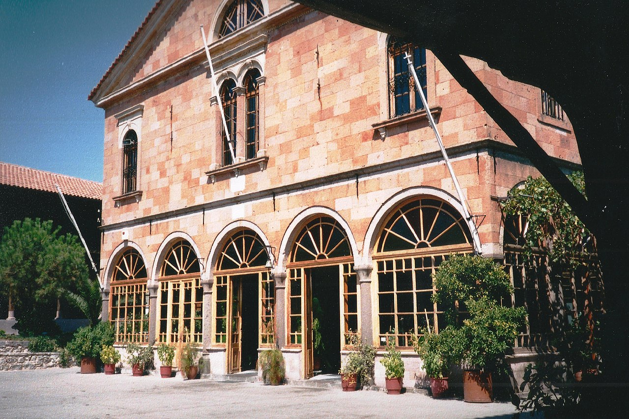
Villages & views · North-east Lesbos
Mantamados
A village 37 km from Mytilene at about 146 m, built in a hollow as protection against medieval pirate raids, with traditional houses and cobbled alleys. It is known for its potteries and its dairy products, set up the island's first communal olive press in 1909, and grew around the pilgrimage monastery of the Taxiarches; the church of Agios Vasileios holds a carved wooden altarpiece of 1750.
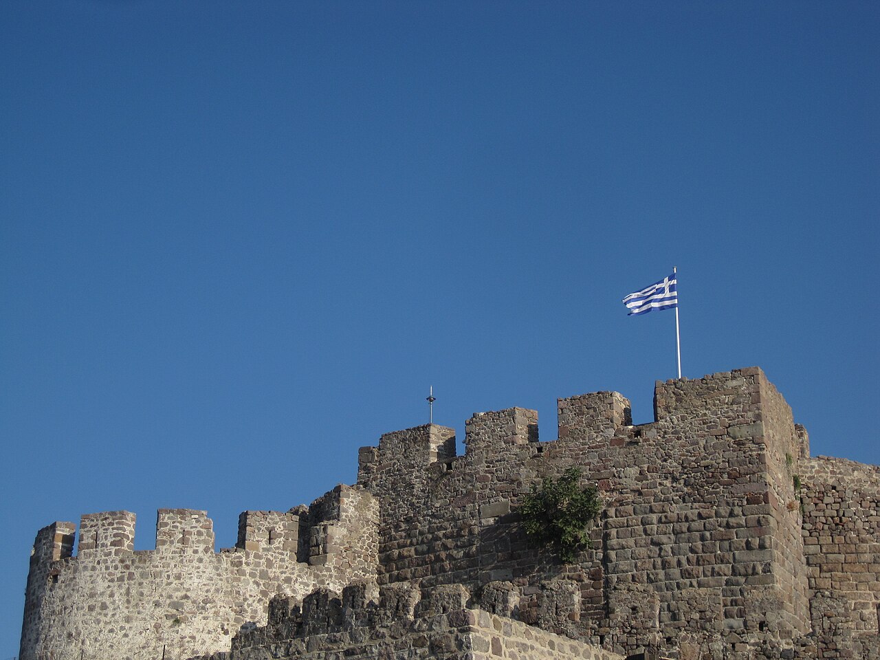
Ancient sites · Molyvos / Mithymna (north Lesbos)
Castle of Mithymna (Molyvos Castle)
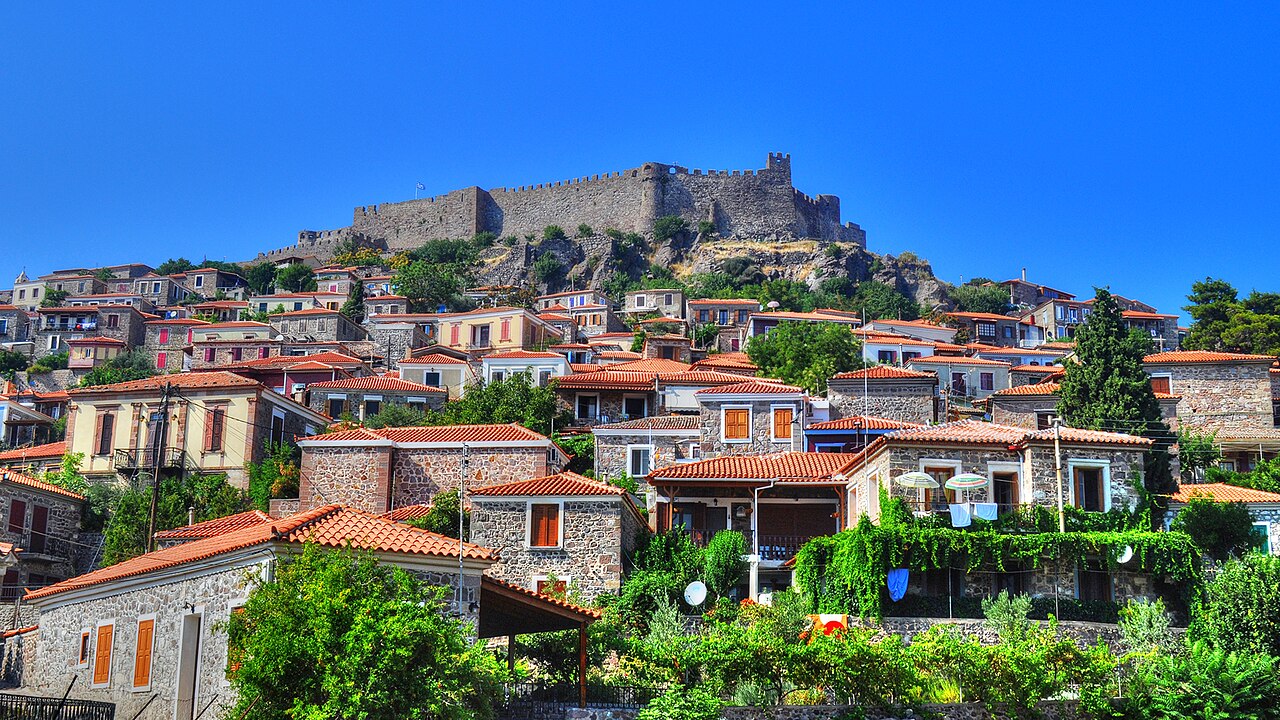
The island's second largest fortress, a trapezoid of roughly 70 m per side reinforced by ten square and round towers and entered through three successive gates. Built of local reddish-brown stone with Byzantine, Gattilusi and Ottoman phases; it retains an acropolis tower with battlements, a vaulted magazine and Byzantine cistern remains, and is used for summer cultural events.
Villages & views · North Lesbos
Mithymna (Molyvos)
A horseshoe of stone houses and cobbled lanes climbing to a Byzantine and Gattilusi castle, 62 km from Mytilene and about 46 m above sea level; it was declared a protected traditional settlement in 1965. Among its buildings are the Taxiarchis basilica of 1795, the neoclassical church of Agios Panteleimon of 1844, Ottoman-period public fountains and the houses of the writers Argyris Eftaliotis and Ilias Venezis.
Beaches · Molyvos (Mithymna), northern Lesbos
Molyvos Beach
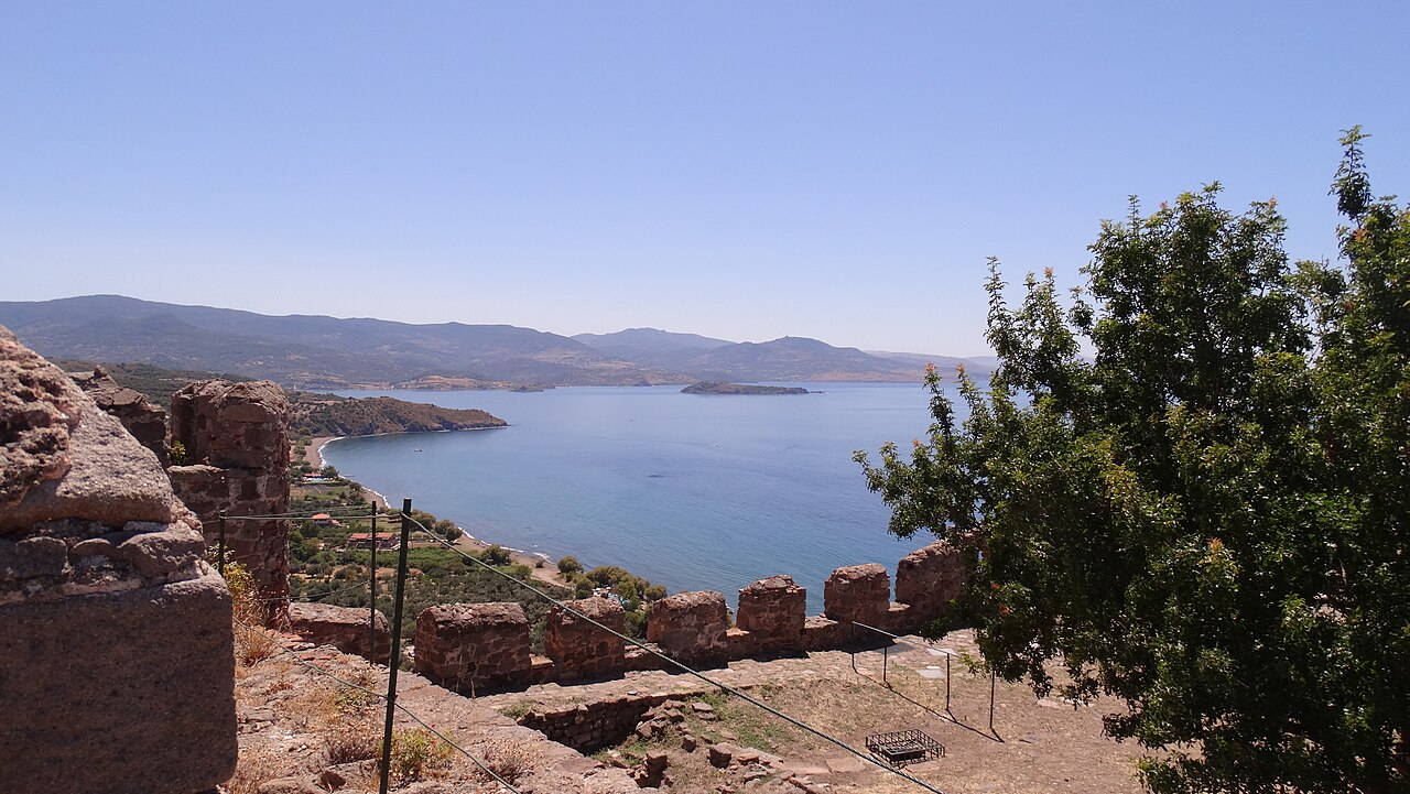
Pebble-and-shingle municipal beach south of Molyvos harbour, below the castle town. OSM also maps a separate naturist beach on the same coast about 1 km further south. The harbour end is lined with fish tavernas and boat-trip operators.
Sea & diving · Molyvos harbour
Molyvos Harbour Boat Trips
Molyvos harbour is the main departure point for day boat excursions on the north coast — typically to Eftalou, Skala Sykaminias and the surrounding coves. Operators sell from boards on the quay; OSM maps the harbour plus two boat-rental businesses on it. Departure times and prices are set locally each season.
Eat & drink · Molyvos harbour
Molyvos Harbour Tavernas
The small fishing harbour below Molyvos castle is ringed by fish tavernas built onto the quay, the best known being To Chtapodi (The Octopus). Tables sit directly over the water and boat-trip operators work from the same quay.
Practical · Molyvos (Mithymna), northern Lesbos
Molyvos Tourist Information
Information points in Molyvos, the main northern resort, mapped in OSM on the main street. A separate 'Trekking Trails' information board stands nearby, and a first-aid post is mapped in the village. Car-hire agencies (including Best Rent a Car, tel +30 22530 72145) and the Mithymna police station are on the same street.
Churches & monasteries · Thermi (east Lesbos)
Monastery of Saints Raphael, Nikolaos and Irene
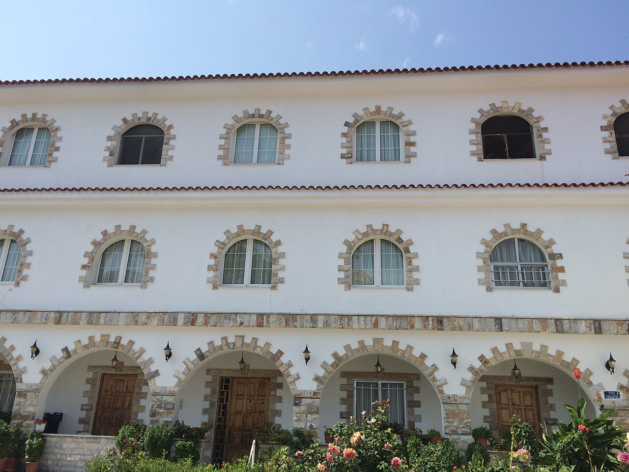
A convent about 3 km from Loutropoli Thermis, on the site of a 12th-century foundation destroyed by pirates in 1235 and converted into a male monastery in 1463 by Raphael and Nikolaos, who with the twelve-year-old Irene were killed during Ottoman rule. It was completely rebuilt in 1964 by Abbess Evgenia Kleidara and now holds the relics of the three neomartyrs; the feast on 9 April draws pilgrims from across the Orthodox world.
Churches & monasteries · Polichnitos (south Lesbos)
Monastery of the Dormition at Damandri
A small post-Byzantine monastery near Polichnitos, consisting of a single-space tile-roofed basilica with its service buildings. Its wall paintings date to the 16th century, with parts apparently repainted in 1733 by Michael Chomatzas of Chios, and the wooden iconostasis was assembled from components taken from neighbouring churches in the late Ottoman period.
Churches & monasteries · Kalloni
Monastery of Leimonos
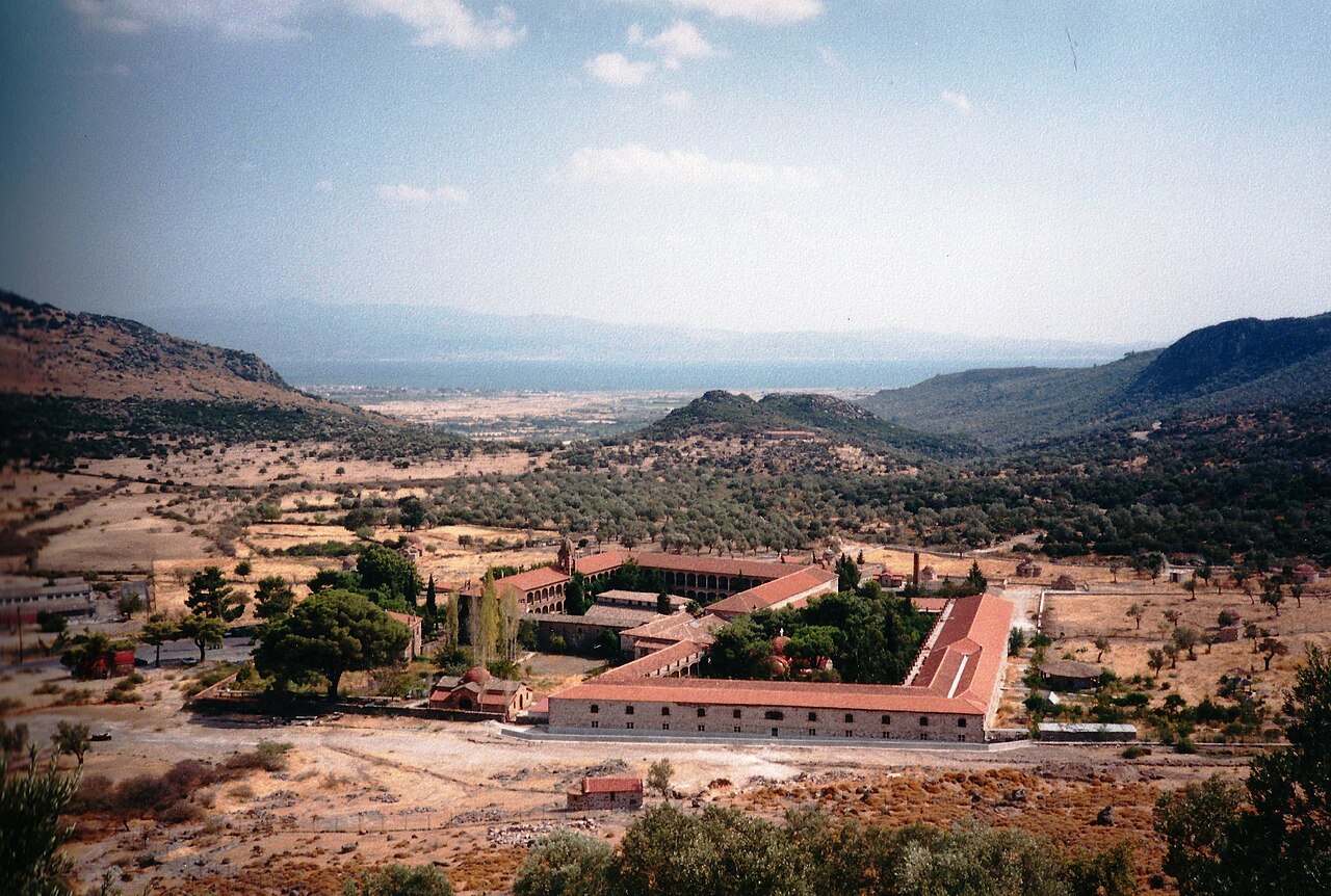
A stauropegic male monastery founded in 1526 by Ignatios Agallianos, Bishop of Mithymna, who was later canonised, standing north-west of Kalloni. The complex has around 42 chapels, monks' cells and an oil press, a three-aisled catholicon of 1795 and 16th-century frescoes in the cemetery chapel, plus a library and church-history museum holding a 9th-century gospel book, patriarchal documents, Ottoman firmans, gold-embroidered vestments, icons and reliquaries. Access to the catholicon is restricted to men.
Churches & monasteries · Kalloni
Monastery of Panagia Myrsiniotissa
A convent in the hills near Kalloni, historically linked to the Leimonos monastery and to its founder Saint Ignatios Agallianos. Together with Leimonos and Perivolis it is one of the three monasteries of the Holy Metropolis of Mithymna.
Churches & monasteries · Antissa (west Lesbos)
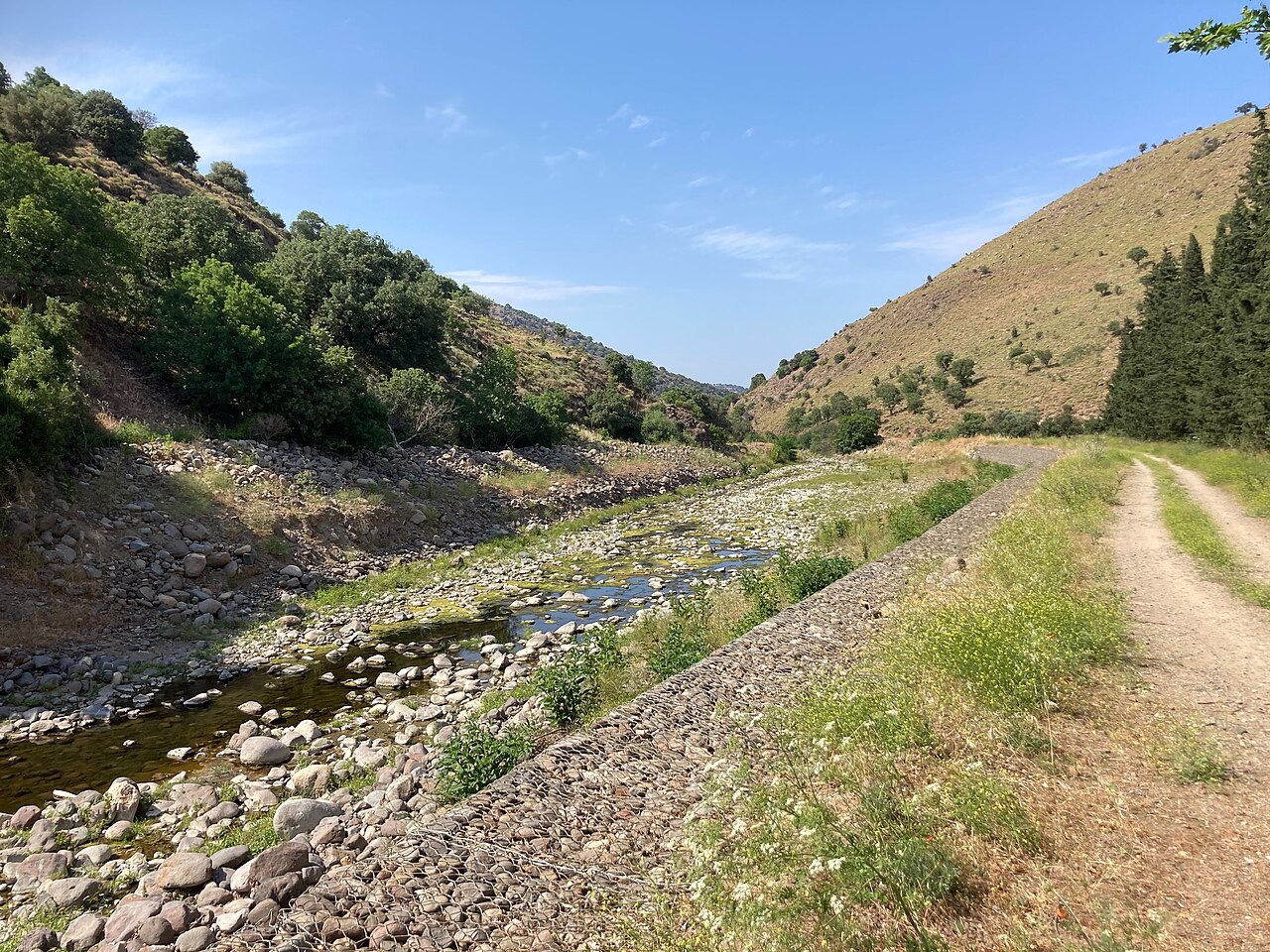
Monastery of Panagia Perivolis
A small convent dedicated to the Presentation of the Theotokos, standing in a green ravine cut by the Voulgaris river south-east of Antissa. The church measures 9.25 by 14.00 m and shows the features typical of early Ottoman-period churches on Lesbos, with low ceilings and narrow doorways, and its interior carries post-Byzantine wall paintings notable for their iconography.
Churches & monasteries · Eresos
Monastery of the Archangels at Pithari
A Byzantine foundation east of Eresos, named after a hollow in the ground shaped like a large clay jar (pithari), and recorded in Ottoman tax registers of 1548 and 1709. It served as an ecclesiastical place of correction for seven years before the Second World War and again until 1964; the catholicon, cells, courtyard and defensive tower have been restored and an artificial lake was created beside it in 2002.
Churches & monasteries · Mantamados (north-east Lesbos)
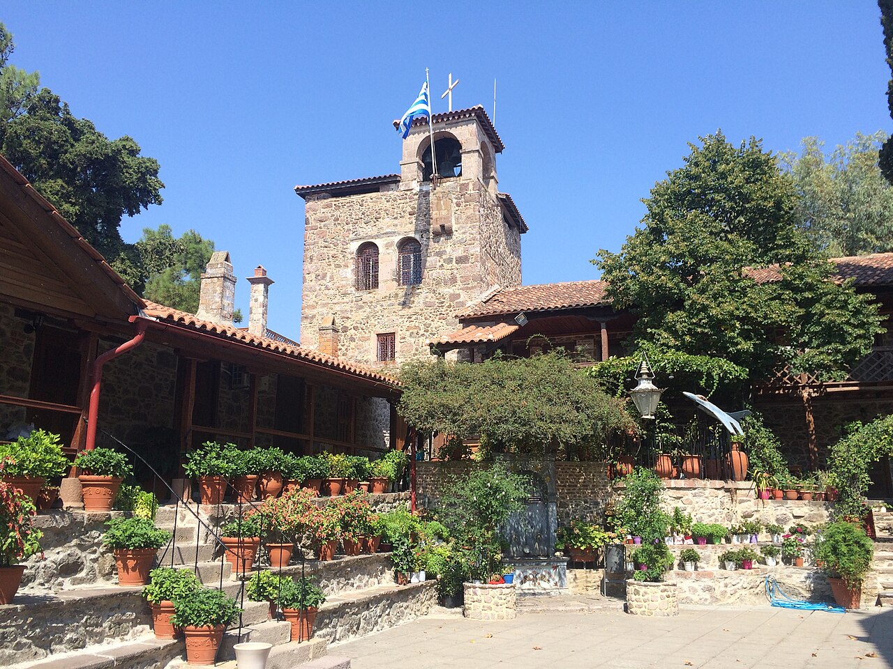
Monastery of the Archangels (Taxiarches) at Mantamados
The island's most visited pilgrimage site, holding one of the very few relief icons in the Orthodox tradition, which according to tradition was made by a surviving novice from wax mixed with the blood-soaked soil left after a Saracen raid. The monastery is documented in 1661; a 17th-century chapel was replaced by an 18th-century church and then by the present three-aisled basilica of 1879, and the main feast falls on the Sunday of the Myrrh-bearing Women.
Churches & monasteries · Mount Ordymnos, near Sigri (west Lesbos)
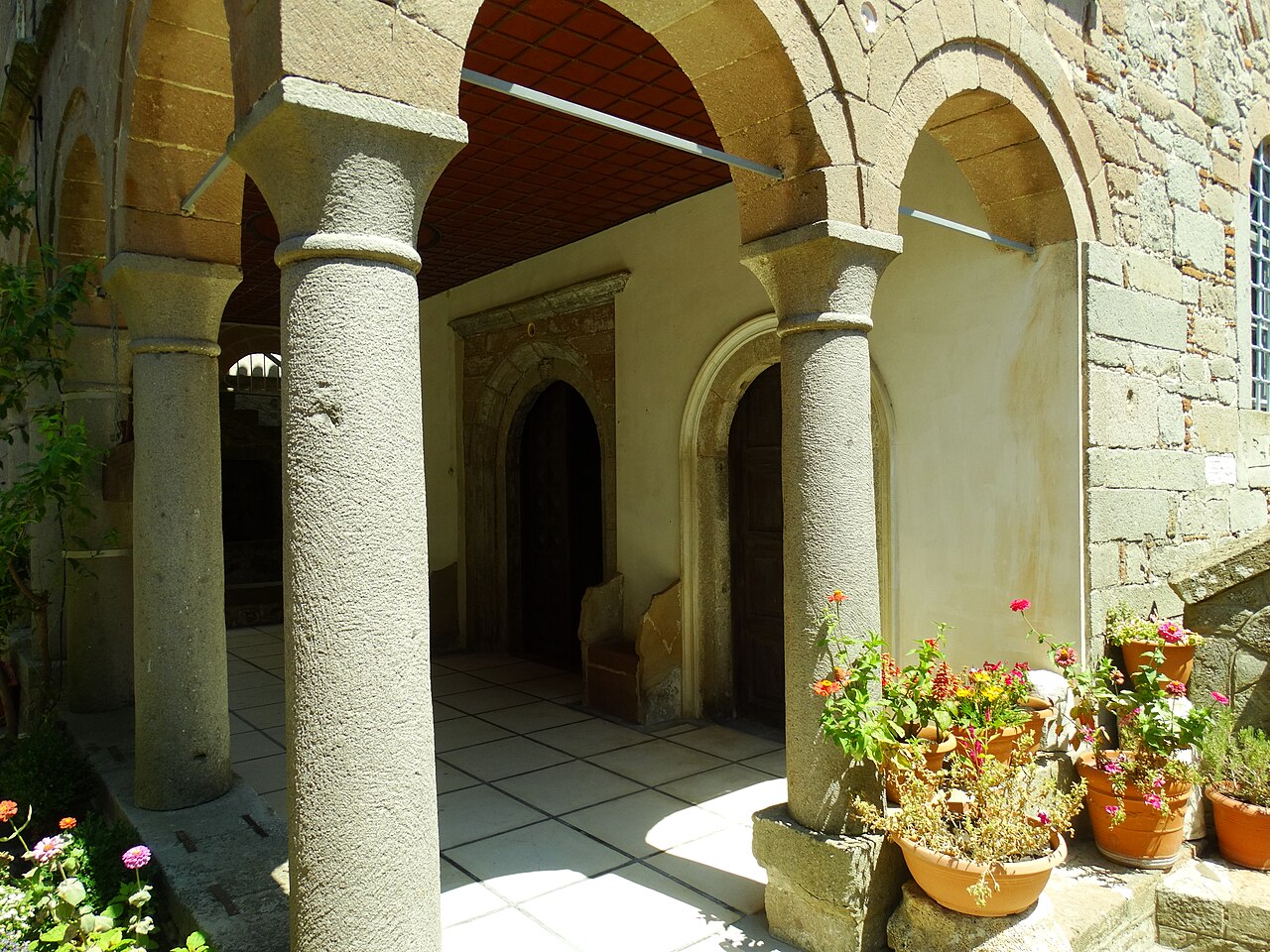
Monastery of Ypsilou (St John the Theologian)
A male monastery on the summit of Mount Ordymnos at 634 m, standing alone above the volcanic badlands between Antissa and Sigri and generally regarded as the oldest on Lesbos; tradition ascribes its foundation to before 800 AD and a patriarchal document of 1331 mentions it. The present catholicon was built in 1832; the monastery keeps a library of manuscript codices, patriarchal and metropolitan letters and printed books of 1535-1845, and a treasury museum of vestments, croziers, reliquaries and gilded gospel books. The gate closes at sunset.
Hiking · Central Lesbos, above Agiasos
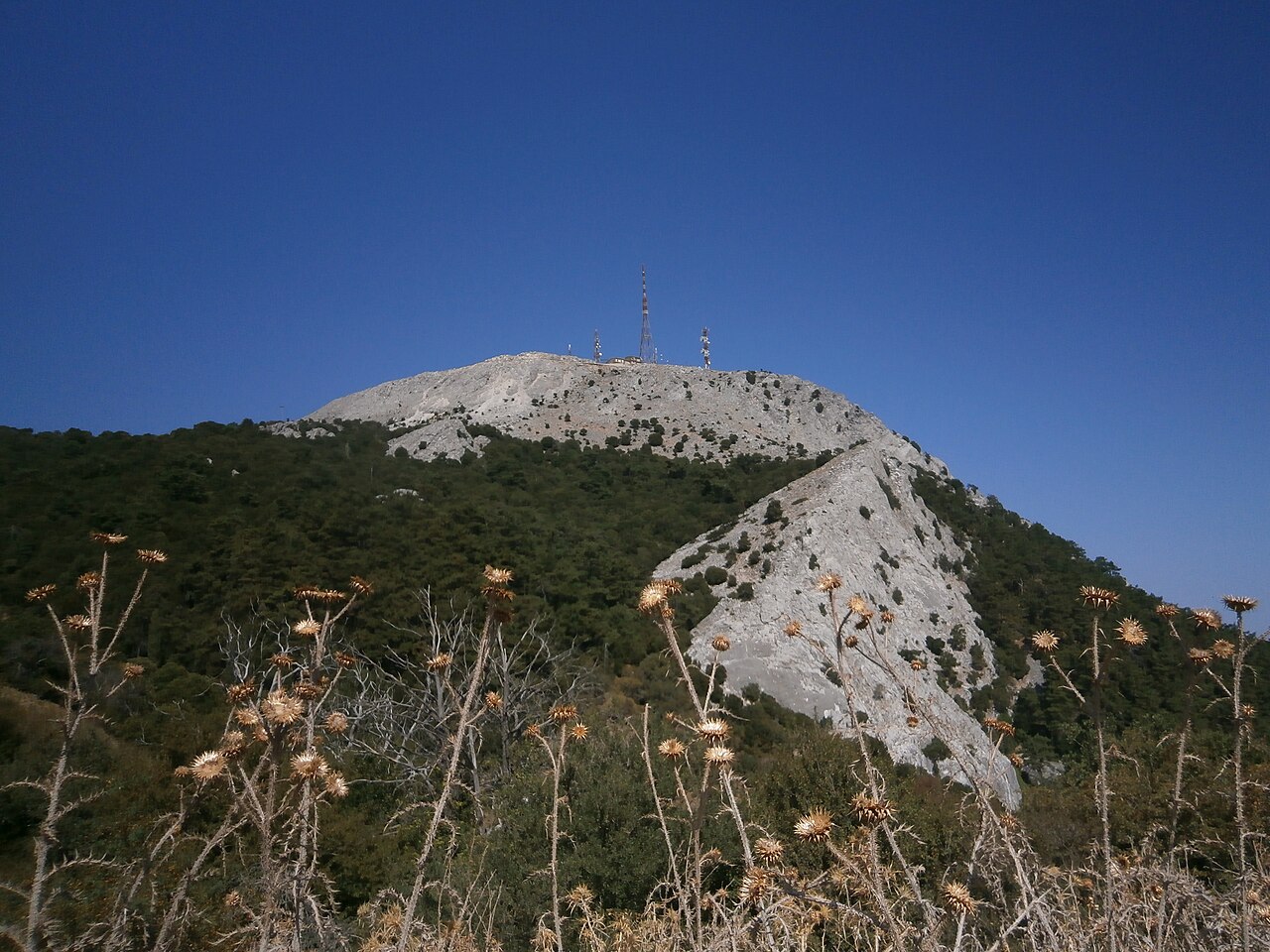
Mount Olympos of Lesbos
The 967 m peak that dominates central Lesbos, rising above Agiasos on its north side. A viewpoint is mapped just below the summit and the mountain is listed among the Lesvos Geopark's notable sites. Access is by mountain road from Agiasos.
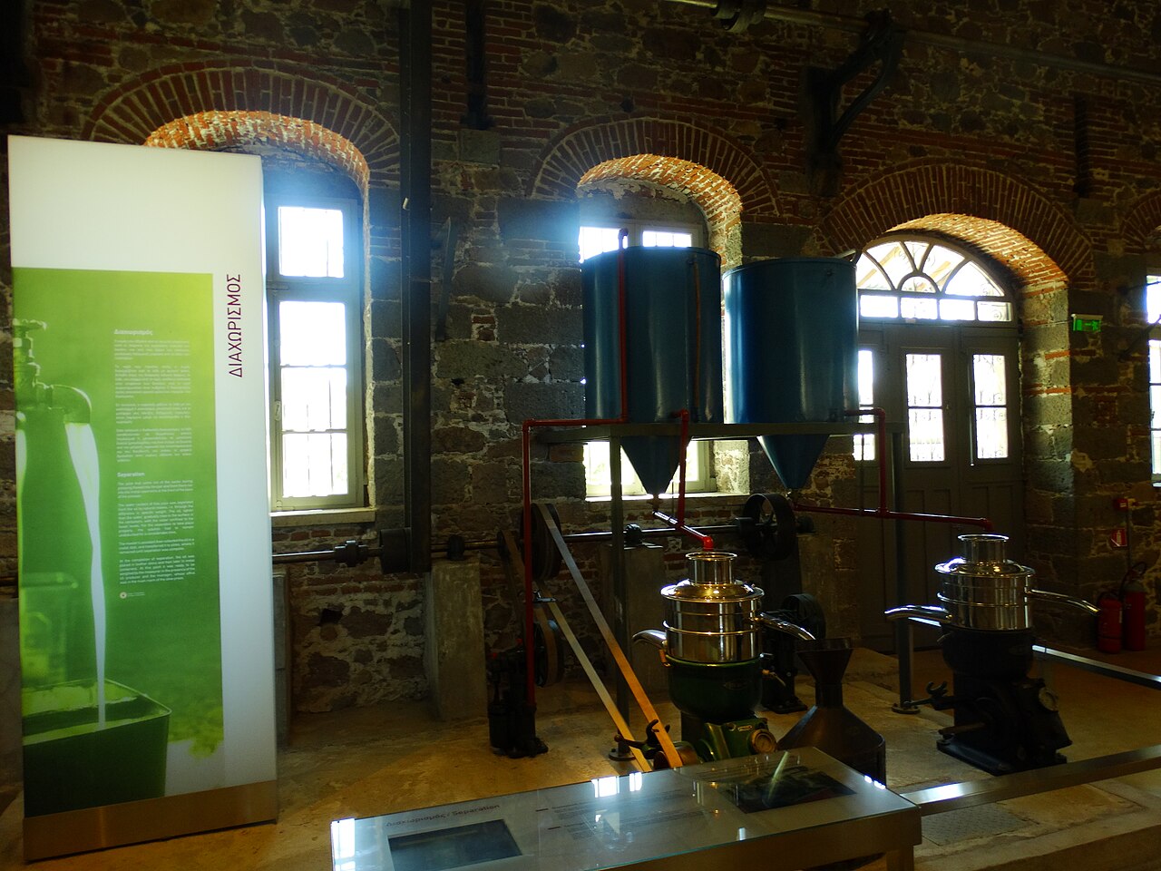
Museums · Agia Paraskevi (central Lesbos)
Museum of Industrial Olive Oil Production of Lesvos
Housed in a restored communal olive mill at Agia Paraskevi and run by the Piraeus Bank Group Cultural Foundation, this museum presents the three stages of mechanised olive oil production - crushing, pressing and separation - with the original machinery in place. Adjoining warehouses cover cultivation, by-products, the oil trade and the trades that grew around it, and the site includes a multipurpose hall, cafe and open-air amphitheatre.
Practical · Kratigos, south of Mytilene
Mytilene International Airport "Odysseas Elytis" (MJT)
The island's only airport, on the coast a few kilometres south of Mytilene town, operated by Fraport Greece. Served by Aegean, Olympic Air and Sky Express domestically, and seasonally by Transavia, Jet2, TUI fly, Brussels Airlines and SAS among others. Terminal hours are seasonal (roughly 06:00-23:45 on weekdays in peak season). A direct airport bus, taxis and car-hire desks operate from the terminal.
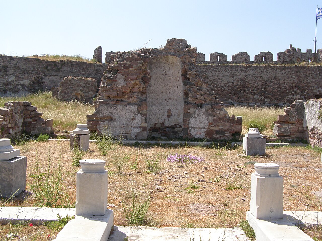
Ancient sites · Mytilene
Castle of Mytilene
One of the largest fortresses in the Mediterranean, occupying the ancient acropolis peninsula on the north-east edge of the modern town and divided into Upper, Middle and Lower Castle. First built in the 6th century under Justinian I, drastically rebuilt by the Genoese Gattilusi (1355-1462) and then altered by the Ottomans, who added round towers, mosques, a hammam and a residential quarter.
Practical · Mytilene
Mytilene Health Centre
Primary-care health centre in Mytilene town for non-emergency and out-of-hours treatment, mapped in OSM as amenity=clinic. Use this rather than the hospital for minor problems.
Sea & diving · Mytilene town harbour
Mytilene Marina
Yacht marina on the south side of Mytilene harbour, adjacent to the sailing club and the Nautical Club of Mytilene. The base for chartered and private yachts sailing out of the island's capital, and the closest berthing to the town centre.
Practical · Mytilene town waterfront
Port of Mytilene
The island's main passenger port, on the town waterfront. Domestic ferries run to Piraeus (the primary mainland link), Chios, Limnos and Thessaloniki; international sailings cross to Ayvalık in Turkey, with occasional services to Dikili. Car-hire desks, the intercity bus station and the digital tourist information point are all within a few hundred metres.
Sea & diving · Mytilene
Sailing Club of Mytilene
The island's sailing club, based at Mytilene marina. Runs dinghy and offshore sailing schools, youth academies and crew/skipper training, and organises regattas including legs of the Aegean Regatta and Greek national championship events. Contact by email; no public phone listed.
Practical · Mytilene town waterfront
Mytilene Digital Information Centre
Visitor information point on the Mytilene waterfront, mapped in OSM with hours Mon-Sat 11:00-14:00 and Sun 08:00-15:00, closed on public holidays. The Lesvos Geopark also runs an information centre in Mytilene, and posts Geopark information boards in Molyvos, Petra, Kalloni, Agiasos, Sigri and at the airport.
Hiking · Napi, north-central Lesbos
Napi Valley
Broad open valley running north from the Kalloni plain towards Mandamados, grazed and dotted with olive terraces and scattered oaks. It is a standard stop on Lesbos birding routes for open-country and scrub species; the stone Kremasti bridge lies at its northern end.
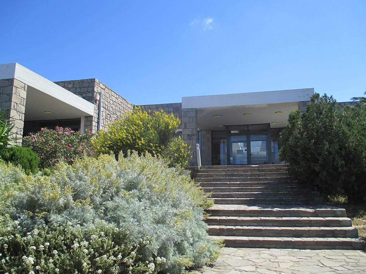
Museums · Vrisa, Polichnitos (south Lesbos)
Natural History Collection of Vrisa
Opened in September 1999 in the old girls' school of Vrisa, this collection presents Pleistocene vertebrate fossils recovered from the nearby Vatera fossil beds, including bones of rhinoceros, camel, antelope, gazelle and elephant and tortoise shells up to 2.5 m long, plus a find attributed to a primate of the genus Paradolichopithecus. It also holds mineral, rock, zoological and botanical exhibits.
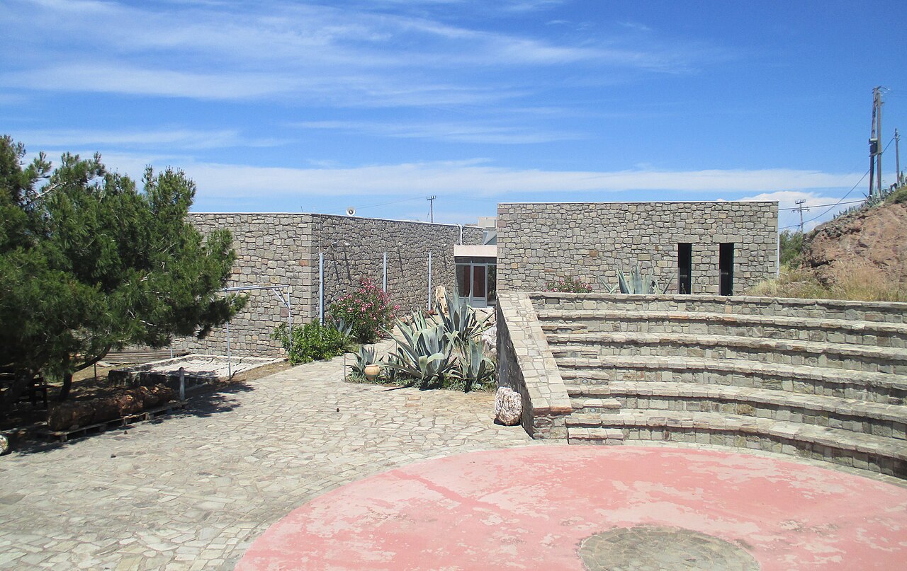
Museums · Sigri
Natural History Museum of the Lesvos Petrified Forest
Founded in 1994 at Sigri, this is the research, conservation and visitor centre for the Petrified Forest and the managing body of the Lesvos Island UNESCO Global Geopark. Displays cover petrified trunks, branches, roots and leaves, the volcanic activity that fossilised them around 20 million years ago, and the geological evolution of Lesvos and the Aegean; it also runs the fossil parks and guided visits. Listed opening hours are Monday-Sunday 09:00-17:00.
Eat & drink · Molyvos (Mithymna), northern Lesbos
Nisi Restaurant
Restaurant in Molyvos, mapped in OSM with opening hours 10:00-23:30 and telephone +30 22530 72172.
Sea & diving · Nisiopi islet, off Sigri, western Lesbos
Nisiopi Marine Petrified Forest Park
Underwater section of the Lesvos Petrified Forest, on and around the islet of Nisiopi off Sigri — the only marine petrified-forest park among the four managed by the Natural History Museum at Sigri. Visits are made by boat from Sigri; check current arrangements and tickets with the museum before travelling. Coordinates deliberately omitted as the islet's mapped node could not be confirmed unambiguously.
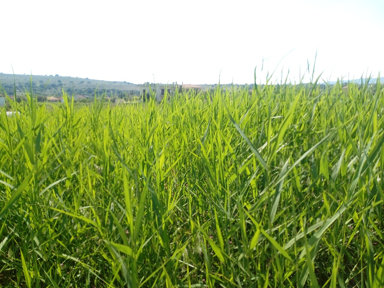
Beaches · Nyfida, Polichnitos municipal unit, southern Lesbos
Nyfida Beach
Sand beach at the small settlement of Nyfida on the outer edge of the Gulf of Kalloni, west of Skala Polichnitou. Quiet, with a short row of tavernas and rooms; the Polichnitos salt pans lie a few kilometres inland.
Eat & drink · Molyvos (Mithymna), northern Lesbos
O Gatos
Long-running taverna in Molyvos with terrace views over the bay, mapped in OSM with opening hours 10:00-24:00 daily and telephone +30 2253 071661.
Eat & drink · Kampos Plagias, Plomari, southern Lesbos
Ouzo Plomari Isidoros Arvanitis Distillery
The largest ouzo producer on Lesbos, at Kampos Plagias just outside Plomari, marking over 130 years of production. It distils in copper stills and grows its own anise on estates at Lisvori. Its visitor operation is the adjacent World of Ouzo museum.
Eat & drink · Papados, Gera, south-east Lesbos
Samara Distillery
Ouzo producer based at Papados in the Gera district, listed in the Greek Wikipedia register of ouzo producers and making red-label and blue-label Mytilene-style ouzo. Address and visitor access unverified; coordinates omitted.
Eat & drink · Mytilene
Spentza Distillery (Ouzo Veto)
Mytilene ouzo house founded in 1892 in Pergamon in Asia Minor and re-established in Mytilene in 1948. The company invites visitors to its Mytilene shop for tastings and a look round the production facilities, though no fixed tour times or street address are published online.
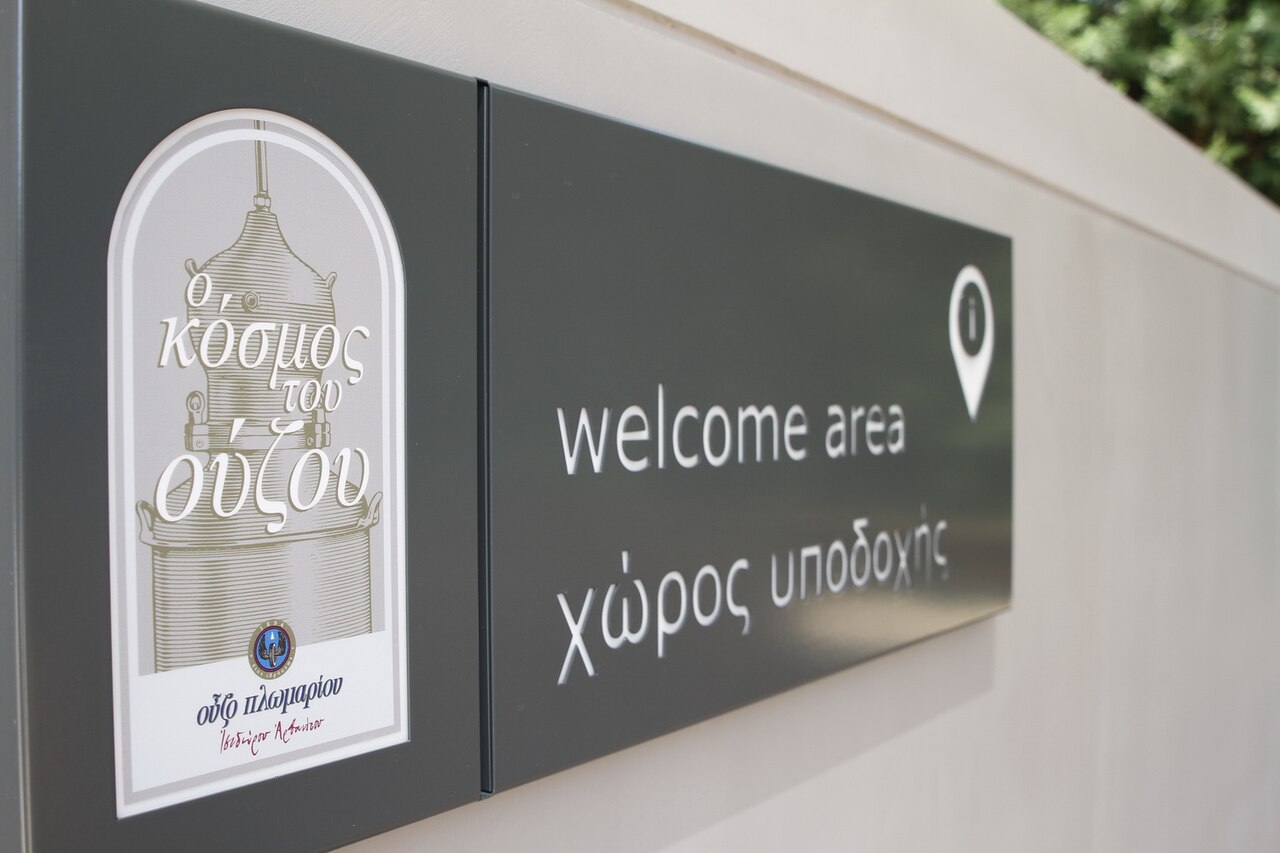
Museums · Plomari (south Lesbos)
World of Ouzo Museum - Isidoros Arvanitis Distillery
A visitor museum inside the working Isidoros Arvanitis (Ouzo Plomari) distillery at Kampos Plagias near Plomari. Visitors handle the botanicals used in the recipe, including anise from nearby Lisvori, see distillation in eighteen hand-made copper stills and the modern bottling line, and view historic equipment, labels, scales and bottles.
Churches & monasteries · Agiasos (central-south Lesbos)
Church of the Dormition of the Theotokos, Agiasos
The pilgrimage church at the heart of Agiasos, built in 1815 after an earlier chapel was demolished in 1806 and its replacement burned in 1812. It is a hip-roofed three-aisled basilica with a narthex and a colonnade on all four sides, decorated inside by 1838, with a 19th-century marble iconostasis, three altar tables and portable icons of the 10th to 19th centuries. Its venerated icon of the Virgin, said to have been brought from Jerusalem by the monk Agathon and inscribed Meter Theou, Agia Sion, gave the village its name; the 15 August litany draws thousands.
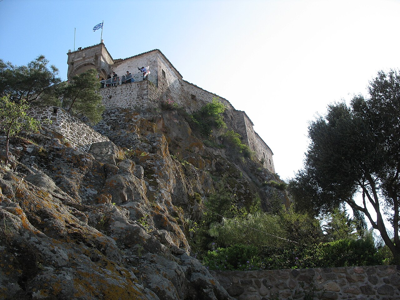
Churches & monasteries · Petra (north Lesbos)
Church of Panagia Glykofilousa, Petra
A three-aisled stone church that crowns the 40 m volcanic rock in the middle of Petra, reached by 114 steps cut into the rock and built so solidly that it resembles a small fort. A chapel probably stood here earlier; the larger church dates from the beginning of the 17th century and was repaired in 1840, and it holds Byzantine icons, a carved and painted iconostasis and a bishop's throne. The feast is on 15 August.
Churches & monasteries · Pyrgoi Thermis (east Lesbos)
Church of Panagia Trouloti, Pyrgoi Thermis
A rare surviving domed Byzantine church of the 14th or 15th century on a hill at Pyrgoi Thermis, built on a four-column cross-in-square plan with a cylindrical drum and later extended westwards. Its masonry incorporates reused marble blocks and ancient inscriptions, and it is unusual in showing the Virgin rather than Christ Pantocrator in the dome; murals of 1650 survive in part.
Villages & views · North-east Lesbos (Lepetymnos foothills)
Pelopi
A mountain village at 396 m in the Mantamados district of the Municipality of Western Lesbos, with 301 permanent residents at the 2021 census; it was formerly called Gelia and had some 260 families in Ottoman times. Panos Dukakis, father of the 1988 US presidential candidate Michael Dukakis, was born here, as was the evolutionary biologist Eleftherios Zouros.
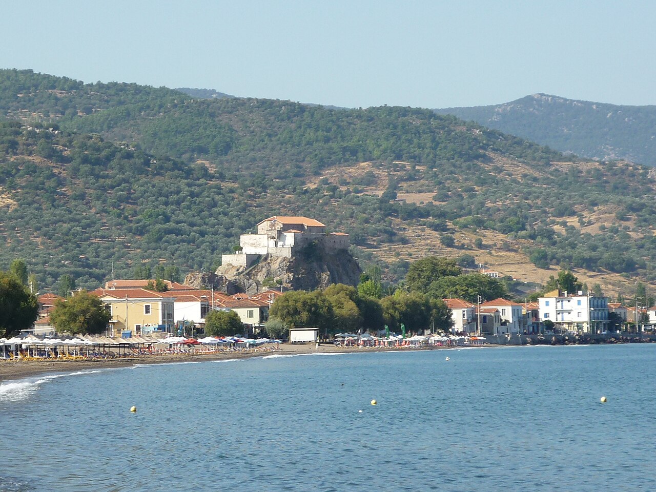
Villages & views · North Lesbos
Petra
A seaside village 57 km from Mytilene, named after the 40 m volcanic rock in its centre that is crowned by the church of Panagia Glykofilousa and reached by 114 rock-cut steps. It has a long sandy beach, a tourism-based economy and the restored Vareltzidaina Mansion, an important late Ottoman house.
Beaches · Petra
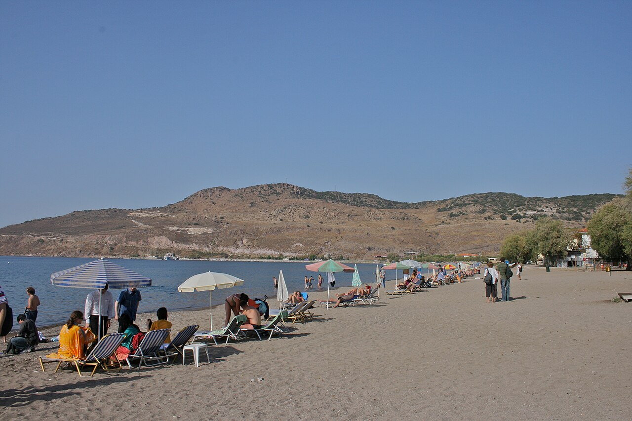
Petra Beach
Long sand beach fronting the resort village of Petra on the north-west coast, directly below the rock-top church of Panagia Glykofilousa. Fully organised in season, with the village's tavernas, the women's cooperative restaurant and boat moorings along the front.
Eat & drink · Petra
Women's Agrotourism Cooperative of Petra
Cooperative-run restaurant on the square in Petra, one of the earliest women's agrotourism cooperatives in Greece, serving home-style Lesbian cooking. OSM records opening hours of 12:00-23:00 daily and telephone +30 22530 41238.
Ancient sites · Between Sigri and Antissa (west Lesbos)
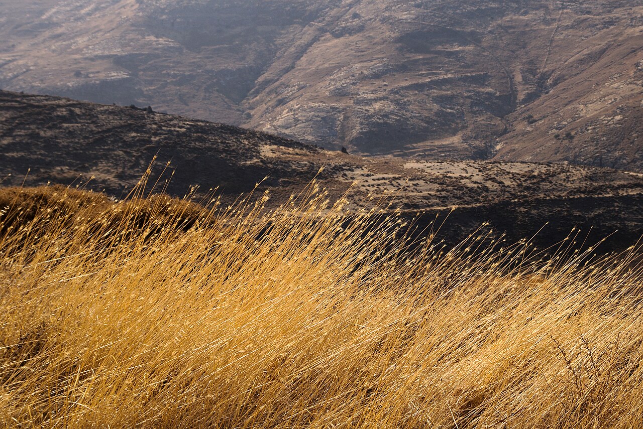
Petrified Forest of Lesvos - Bali Alonia Park
A fenced park on the Sigri-Antissa road holding upright petrified trunks, root systems, conifers and angiosperms preserved where they grew, part of the Lesvos Petrified Forest created by volcanic eruptions and ash falls 17-20 million years ago. The forest was declared a Protected Natural Monument of Greece in 1985 and is the core of the Lesvos Island UNESCO Global Geopark; the park has marked walking paths, rest points and viewpoints and is open daily 08:00-16:00.
Hiking · Sigri and Bali-Alonia, western Lesbos
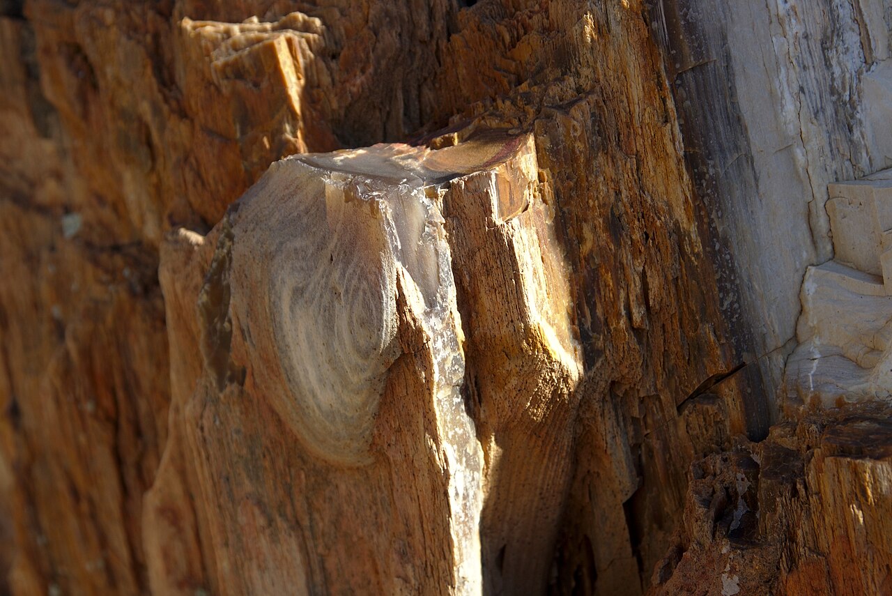
Petrified Forest of Lesvos
UNESCO Global Geopark site protecting an Early Miocene fossil forest of upright and fallen silicified trunks in the volcanic terrain of western Lesbos. The Natural History Museum at Sigri manages four parks with walking routes through them: the main Petrified Forest Park (Plaka), the Sigri Park, Bali-Alonia Park and the underwater Nisiopi Marine Park. Parks generally open 08:00-16:00, museum 09:00-17:00.
Eat & drink · Plomari
Pitsiladi Distillery
One of the four ouzo distilleries operating in Plomari, listed in the Greek Wikipedia register of Greek ouzo producers as producing Plomari-style ouzo. No official website, street address, coordinates or visitor programme could be verified, so coordinates are deliberately omitted.
Villages & views · South Lesbos
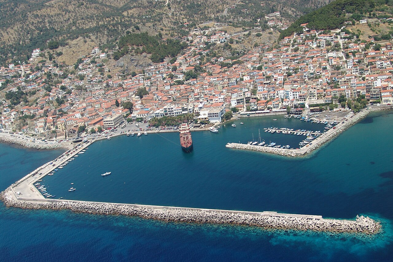
Plomari
The main town of the south coast and the centre of the island's ouzo and luxury soap industries, which grew into export businesses from the 19th century onwards. Its layout and architecture are shaped by that industrial past, with olive presses, soap works and boatyards among the houses; the church of Agios Nikolaos dates from 1847 and a plane tree in the main square is said to have been planted in 1813.
Eat & drink · Plomari waterfront, southern Lesbos
Plomari Waterfront Ouzeries and Cafés
Plomari, the island's second-largest settlement and the acknowledged home of ouzo, has its cafés and ouzeries concentrated round the seafront square and the plane tree of the old quarter (said to have been planted in 1813). OSM maps a dense run of cafés and tavernas along the front, including Athanasiadeion, Embeeries, En Plo and Ambrosia.
Villages & views · South Lesbos
Polichnitos
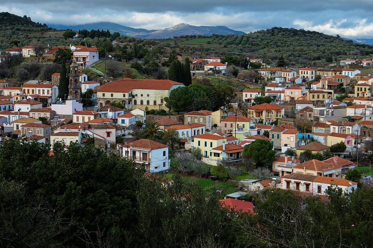
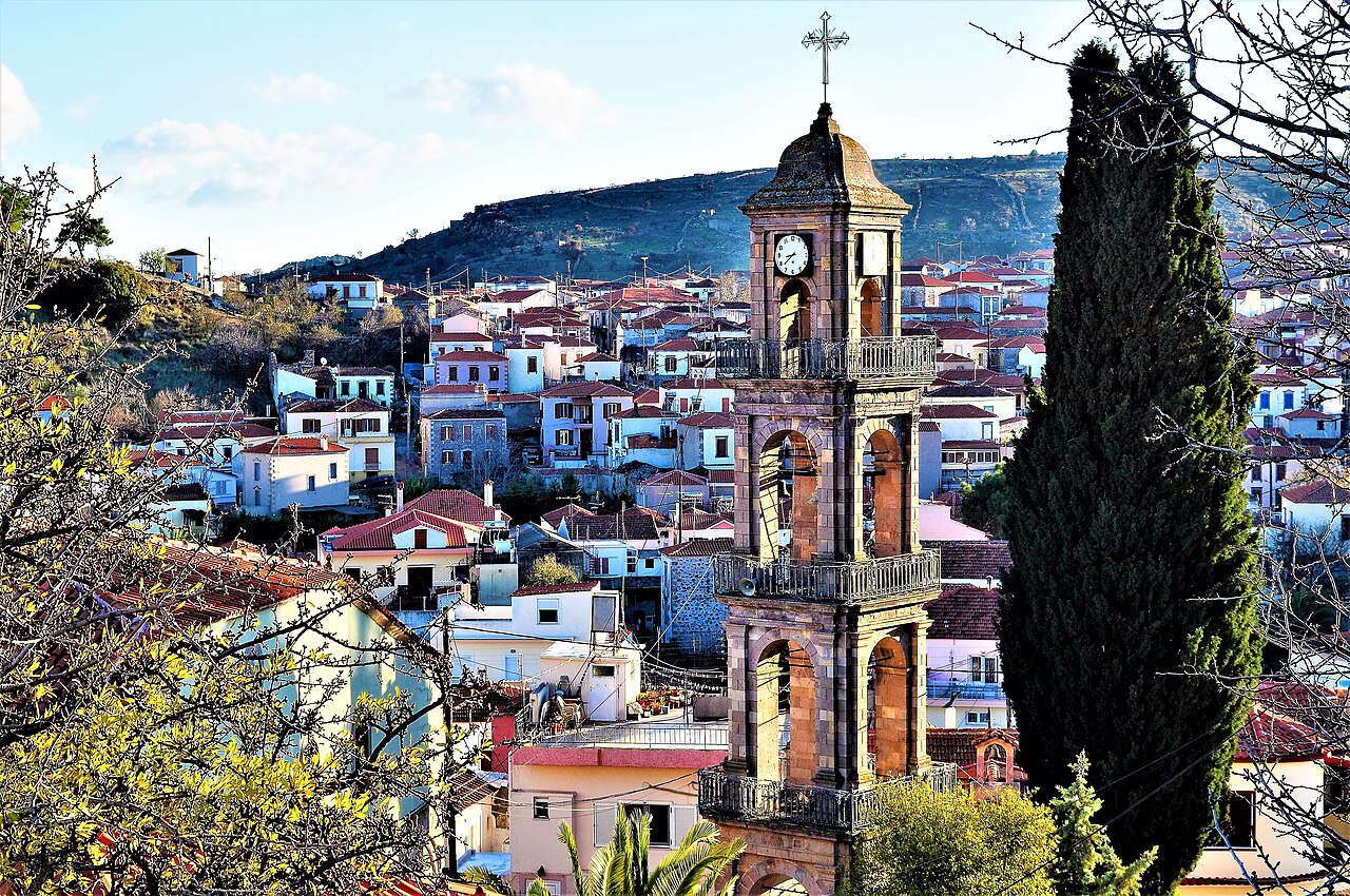
A densely built town at 105 m, 46 km from Mytilene, formed by the merging of smaller settlements and mixing neoclassical and oriental architecture along cobbled alleys with notable 19th-century industrial buildings. The church of Agios Georgios of 1892 has a three-storey dressed-stone bell tower, a former church-owned olive press now serves as a cultural centre, and the hot springs and Skala Polichnitou lie nearby.
Practical · Polichnitos, southern Lesbos
Polichnitos Health Centre
Health centre for the southern part of the island, operated under Mytilene hospital and the nearest staffed facility to Vatera and Nyfida. Telephone +30 22520 41111 as recorded in OSM.
Hiking · Polichnitos, southern Lesbos
Polichnitos Hot Springs
Thermal bathhouse on the road out of Polichnitos, one of the island's principal hot springs. Two domed stone bath chambers are fed by very hot mineral water. Opening arrangements are seasonal and locally managed; no official website was found.
Hiking · Polichnitos, southern Gulf of Kalloni
Polichnitos Salt Pans
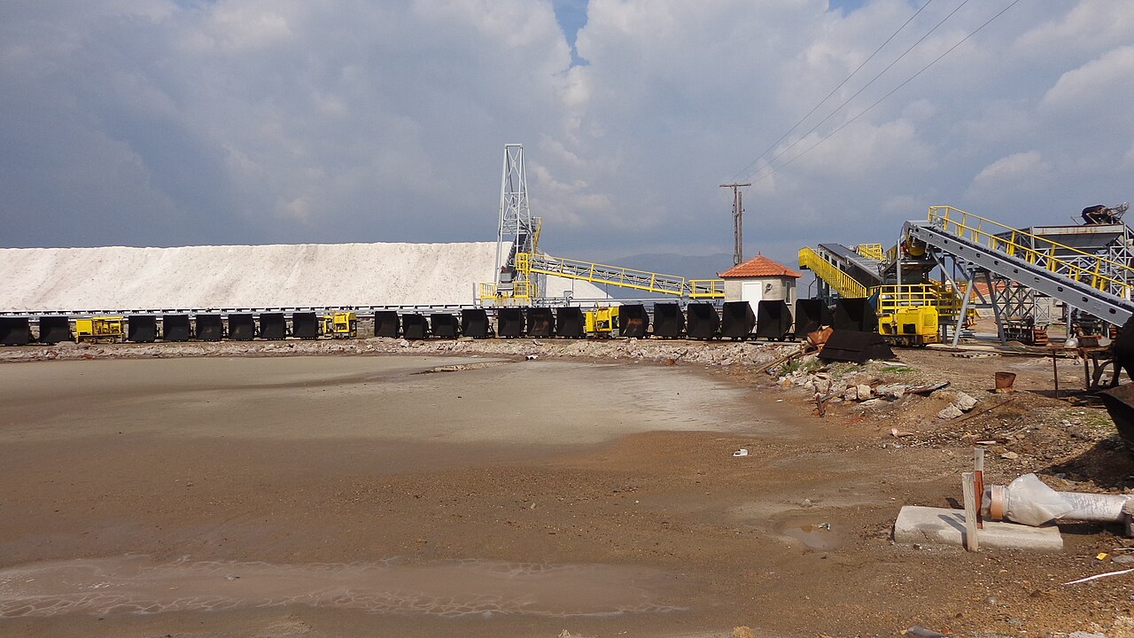
Second set of salt pans on the Gulf of Kalloni, between Polichnitos and Skala Polichnitou, mapped in OSM as saltmarsh with an extensive grid of pans. Quieter than the Kalloni pans and part of the same gulf wetland complex used by flamingos and waders.
Sea & diving · Molyvos harbour
Rent Boat Lesvos
Boat-hire operator at Molyvos, mapped in OSM as amenity=boat_rental on the harbour front. No website or phone recorded; enquire at the harbour.
Ancient sites · Moria (east Lesbos)
Roman Aqueduct of Moria
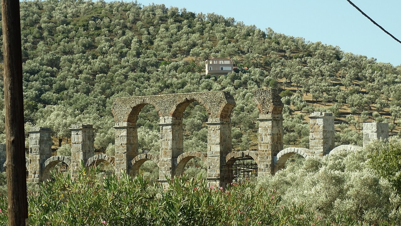
The best preserved surviving stretch of the Roman aqueduct that carried water 26 km from the springs of Mount Olympos to ancient Mytilene, probably built in the late 2nd or early 3rd century AD. The marble and stone water bridge is about 117 m long and 24.5 m high, with 16 pillars and 17 arched openings arranged in three tiers.
Ancient sites · Gulf of Kalloni (central Lesbos)
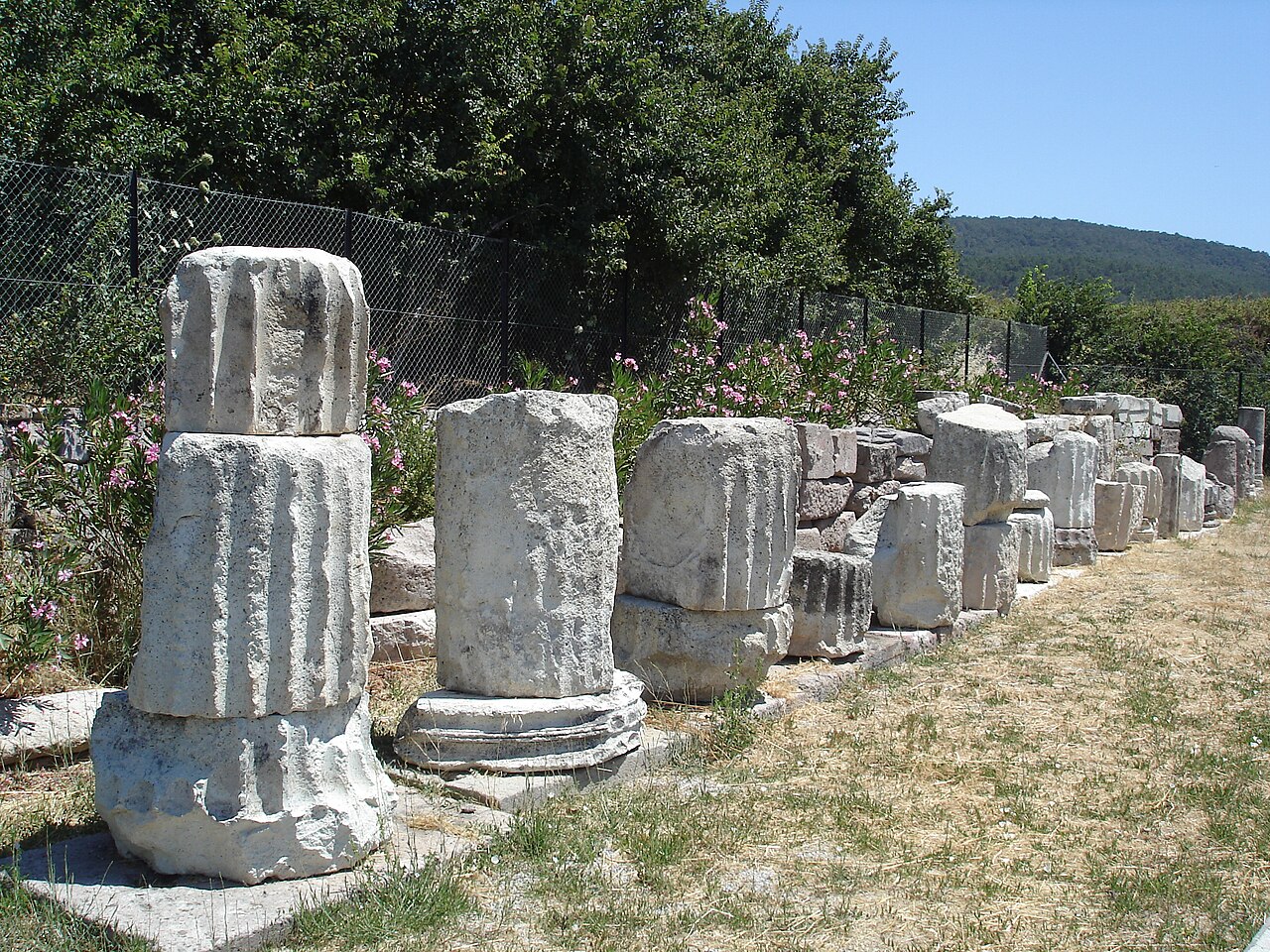
Sanctuary and Temple at Mesa
A monumental Ionic pseudo-peripteral temple of about 330-300 BC measuring 41.55 x 23.78 m with 8 x 14 columns, standing in the plain at the head of the Gulf of Kalloni. It was the common sanctuary of the Lesbians, probably dedicated to the Lesbian triad of Zeus, Hera and Dionysos, and was destroyed by an earthquake in the 3rd century AD.
Villages & views · West Lesbos
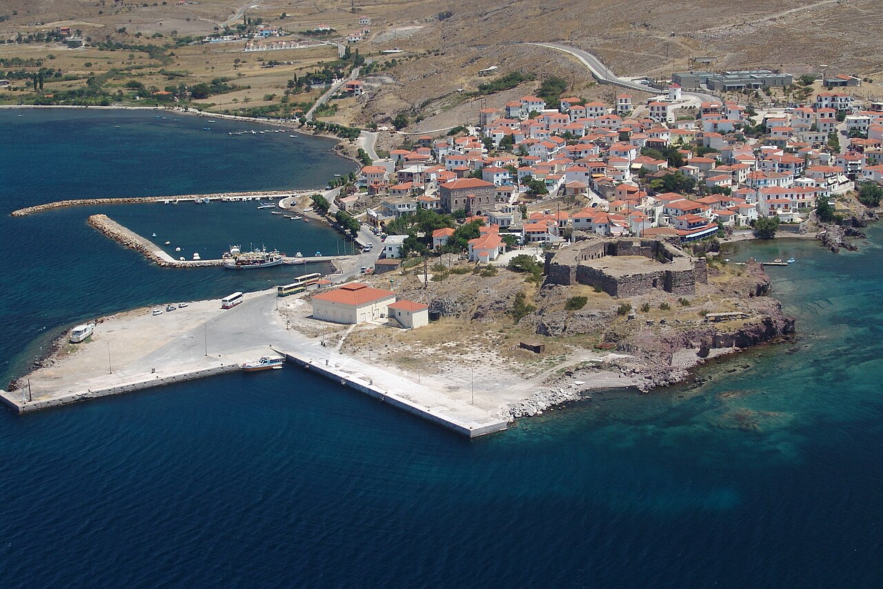
Sigri
The westernmost settlement on Lesbos, 94 km from Mytilene, with a harbour sheltered by the islets of Nisiopi and Sedousa. It is dominated by the Ottoman fort of 1757 and is the base for the Petrified Forest, with the Natural History Museum in the village and fossil parks nearby; remains of a converted mosque and a Turkish bath survive, and there is a sandy beach at Panagia Faneromeni.
Ancient sites · Sigri
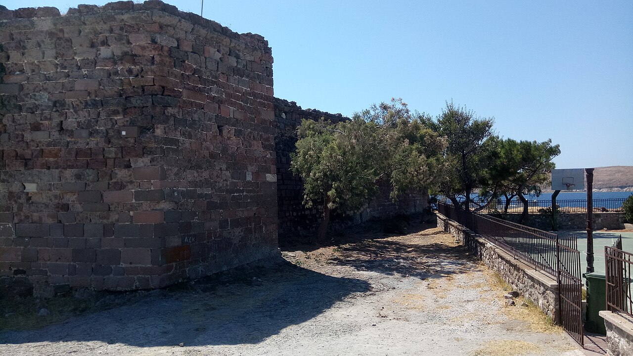
Castle of Sigri
A square Ottoman fort with four corner towers, bastions and a cannon platform, built in 1757 by the Ottoman admiral Suleyman Pasha to protect shipping and the westernmost anchorage of Lesbos from pirates. It is built of brown-red trachyte, has a gate with an Arabic-style arch, was damaged by the 1889 earthquake and is currently under restoration by the Archaeological Service and not yet open to the public.
Hiking · Western Lesbos, between Sigri and Eressos
Sigri-Eressos Trekking Trail
Gravel-surfaced trekking route crossing the volcanic badlands of western Lesbos between Sigri and Eressos, mapped in OSM as a continuous named way. It runs through the open petrified-forest landscape and past the Limena and Faros wetlands; there is no shade and no water on the route.
Practical · Sigri, western Lesbos
Port of Sigri
Small ferry port at the far western tip of the island, mapped in OSM as both an old and a new ferry terminal. It handles a limited seasonal service and is not a substitute for Mytilene for most journeys — confirm sailings before planning around it.
Beaches · Skala Eressou, Eresos-Antissa, western Lesbos
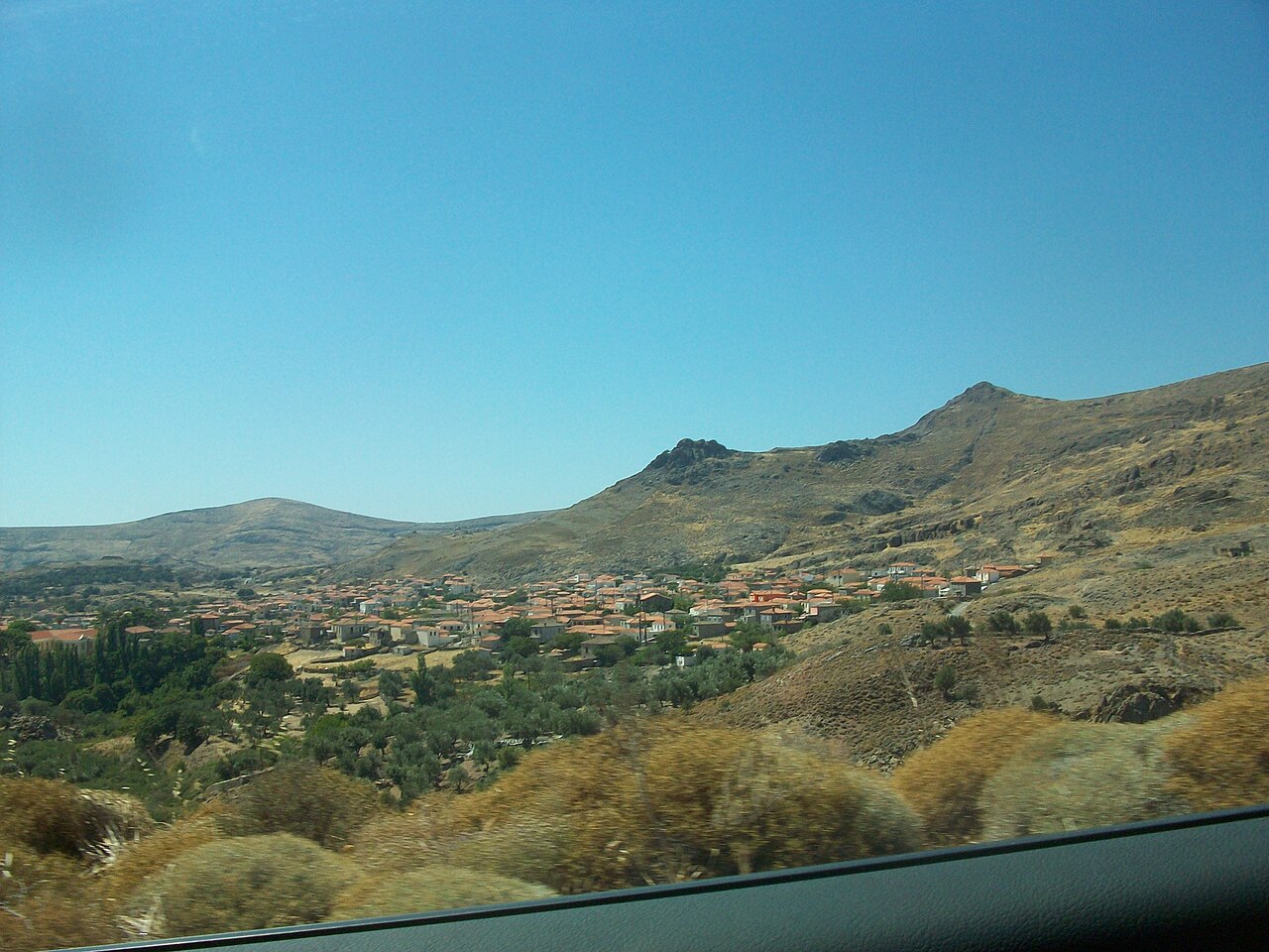
Skala Eressou Beach
Wide dark-sand beach running west from the village square on the exposed south-west coast. OSM maps a continuous chain of sand beach segments here, with a signed nudist section about 1 km further west. The village behind it has a dense line of tavernas, cafés and a rural clinic.
Sea & diving · Skala Eressou, western Lesbos
Skala Eressou Watersports Beach
Skala Eressou's long, open south-west-facing beach is the island's usual reference point for windsurfing and kitesurfing because of its exposure and afternoon breeze. Important caveat: no windsurf or kite school here could be verified as currently trading — the only verified water-sports operator on the beach is Black Rock Dive Centre. Treat board hire as something to confirm on arrival.
Beaches · Skala Kallonis, Gulf of Kalloni
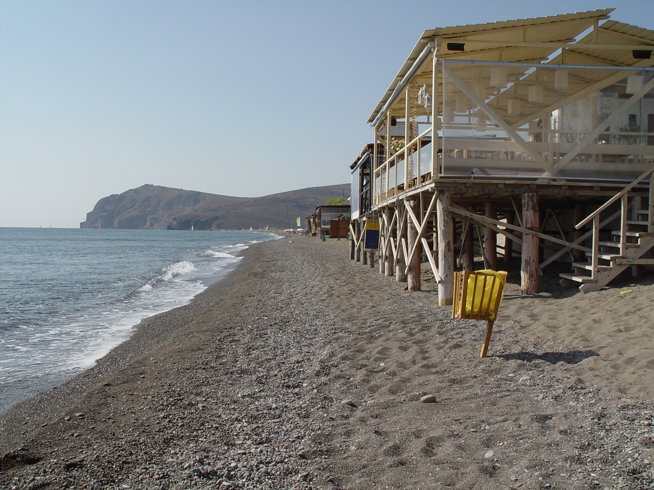
Skala Kallonis Beach
Shallow, very gently shelving beach at the head of the Gulf of Kalloni, backed by the village's line of fish tavernas and cafés. The water is warm and calm but the setting is estuarine rather than clear-blue; the main draw here is the adjacent salt pans and bird hides.
Eat & drink · Skala Kallonis, Gulf of Kalloni
Skala Kallonis Waterfront Fish Tavernas
The waterfront at Skala Kallonis is the island's main place to eat the small Kalloni Gulf sardine (papalina), traditionally salt-cured and eaten raw or lightly grilled. OSM maps a dense cluster of tavernas and cafés along the front, including Mimis, Dionysos, Sea Horse, Caprice and Sampo.
Villages & views · North Lesbos
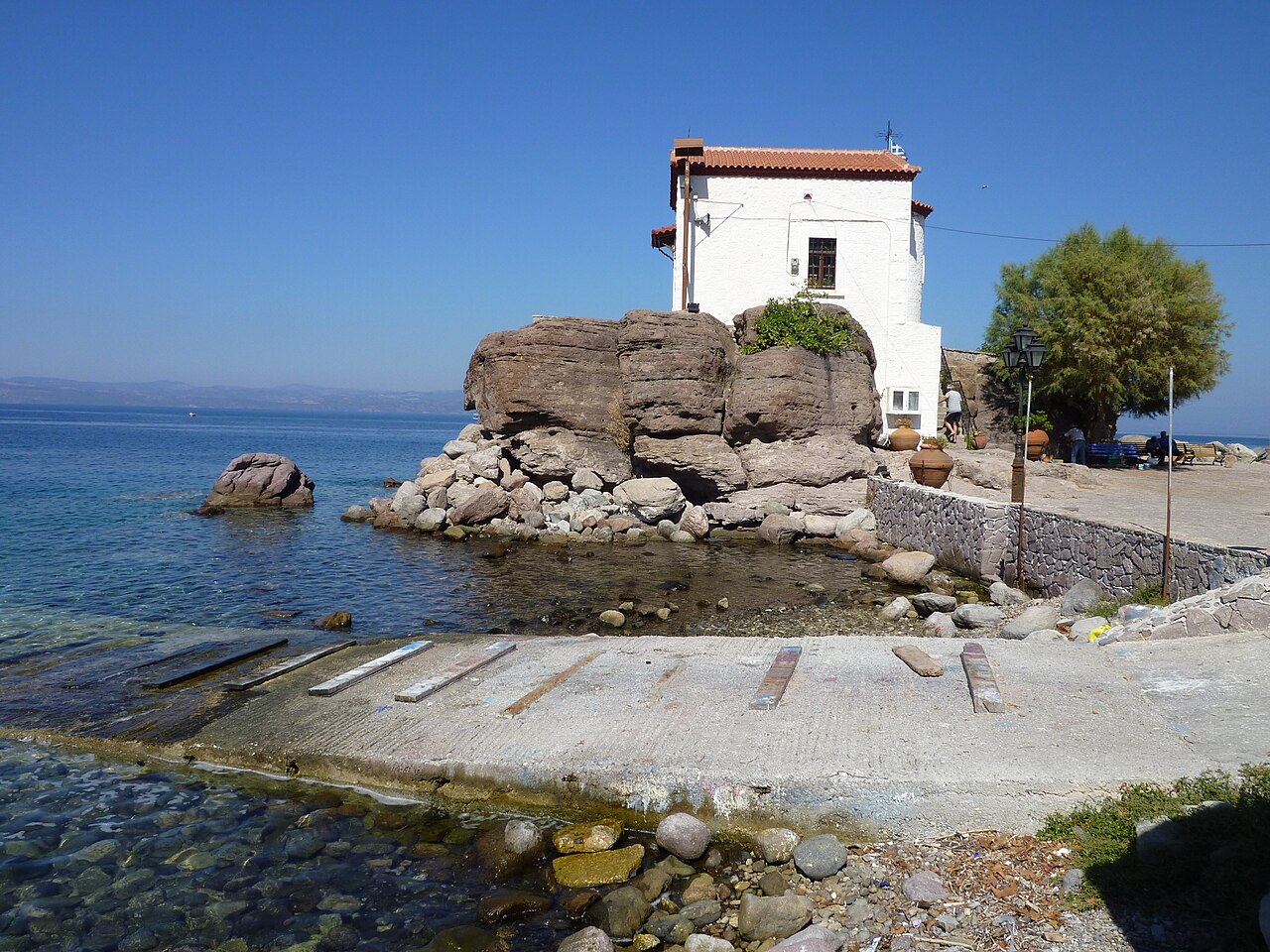
Sykaminia and Skala Sykaminias
A hillside village at about 291 m, 49 km from Mytilene, with cobbled alleys, old fountains and 19th-century stone mansions, named after the mulberry trees that grew here. It was the birthplace of the writer Stratis Myrivilis, commemorated by a statue and by the mulberry tree in the square; its small harbour, Skala Sykaminias, is dominated by the chapel of Panagia Gorgona built on a rock at the water's edge.
Beaches · Tarti, Mytilene municipality, south-east Lesbos
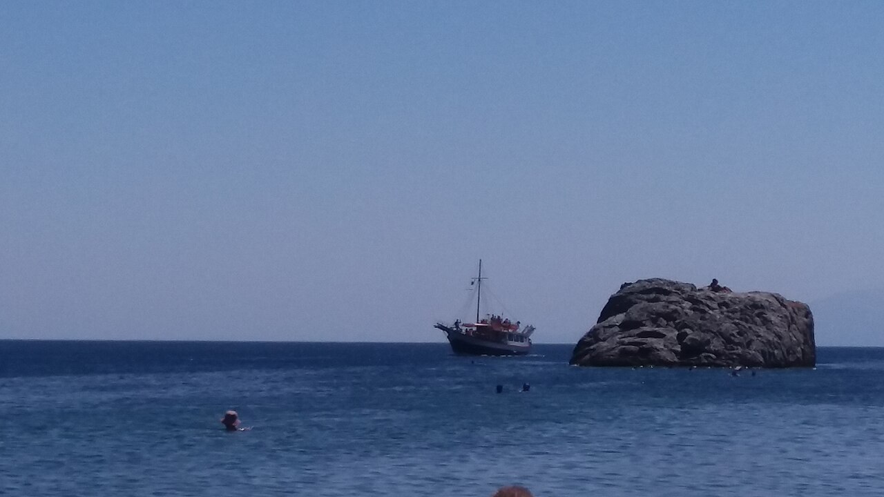
Tarti Beach
Small sheltered cove on the south-east coast between the Gulf of Gera and Plomari, reached by a winding road from Papados. A cluster of neighbouring coves (Tsafi, Ntalantos, Ligonari, Tsilia) lies within a couple of kilometres.
Museums · Varia, Mytilene (east Lesbos)
Stratis Eleftheriadis-Teriade Museum and Library
Opened in August 1979 in the painter's home village of Varia outside Mytilene, this museum holds the complete publishing output of the Lesbos-born Paris publisher Stratis Eleftheriadis (Teriade). The permanent collection includes issues of the review Verve and the Grands Livres with original works by Chagall, Picasso, Matisse and others, alongside facsimiles of medieval manuscripts; it also hosts retrospective exhibitions.
Museums · Varia, Mytilene (east Lesbos)
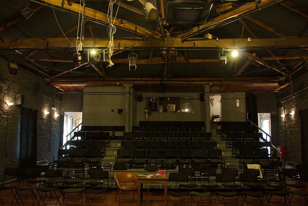
Theophilos Museum
A purpose-built museum of 1964 in an olive grove at Varia, holding 86 works by the Lesbos folk painter Theophilos Hatzimichail across four halls. The paintings, showing rural and everyday scenes, landscapes and historical figures such as Alexander the Great and heroes of 1821, came from the private collection of publisher Stratis Eleftheriadis-Teriade, who donated the museum to the Municipality of Mytilene in 1965.
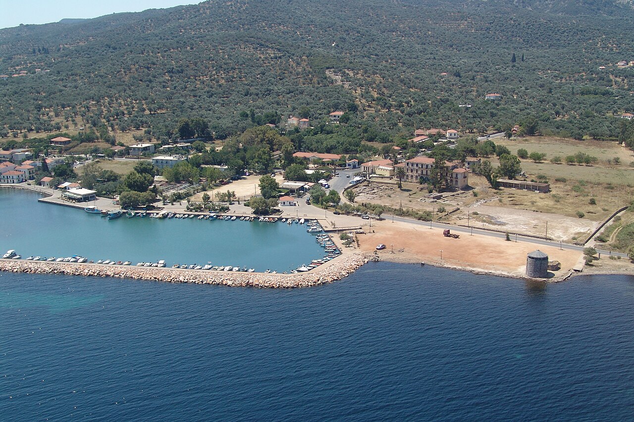
Hiking · Gulf of Gera, 7th km Mytilene-Kalloni road
Therma Spa, Gulf of Gera
Commercially run thermal spa on the Gulf of Gera at the 7th km of the Mytilene-Kalloni road, with thermal pools, hydromassage, massage treatments and its own beach. Listed by the Lesvos Geopark as a field-activity site. Open daily 09:00-21:00; water temperature and mineral analysis are not published on the site.
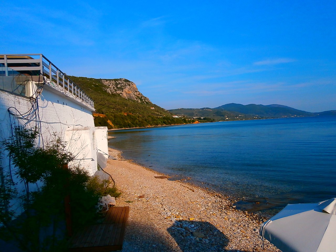
Hiking · Loutropoli Thermis, north of Mytilene
Loutropoli Thermis
Small spa village 10 km north of Mytilene whose name means 'spa town of Thermi'. Its landmark, the Sarlitza spa hotel, is mapped in OSM as ruins; the surviving bath facilities are modest and locally run, and the seafront at Paralia Thermis nearby has tavernas and cafés. Verify current bathhouse opening locally before travelling.
Ancient sites · Loutropoli Thermis (east Lesbos)
Prehistoric Settlement of Thermi
A Bronze Age town on the shore at Pyrgoi Thermis, about 10 km north of Mytilene, with five successive Early Bronze Age phases dated 3200-2400 BC and later occupation to around 1300 BC. It was excavated between 1929 and 1933 by Winifred Lamb for the British School at Athens; visible remains include radial and block-planned housing, streets, fortification walls and bastions.
Beaches · Tsonia, northern Lesbos
Tsonia Beach
Sand beach on the north coast below the hamlet of Tsonia, mapped in OSM with a sand surface. It sits on the quiet stretch of coast east of Skala Sykaminias, facing the Turkish shore.
Villages & views · North Lesbos (above Molyvos)
Vafeios
A small village of about 130 residents at 300 m on the slopes of Mount Lepetymnos, roughly 5 km inland from Molyvos, in the Municipality of Western Lesbos. It is known locally for its sunset views over the north coast and for the huge detached boulders called Rachta, which have been secured to the hillside with heavy chains; the church of Agia Paraskevi in the centre keeps its old wooden iconostasis.
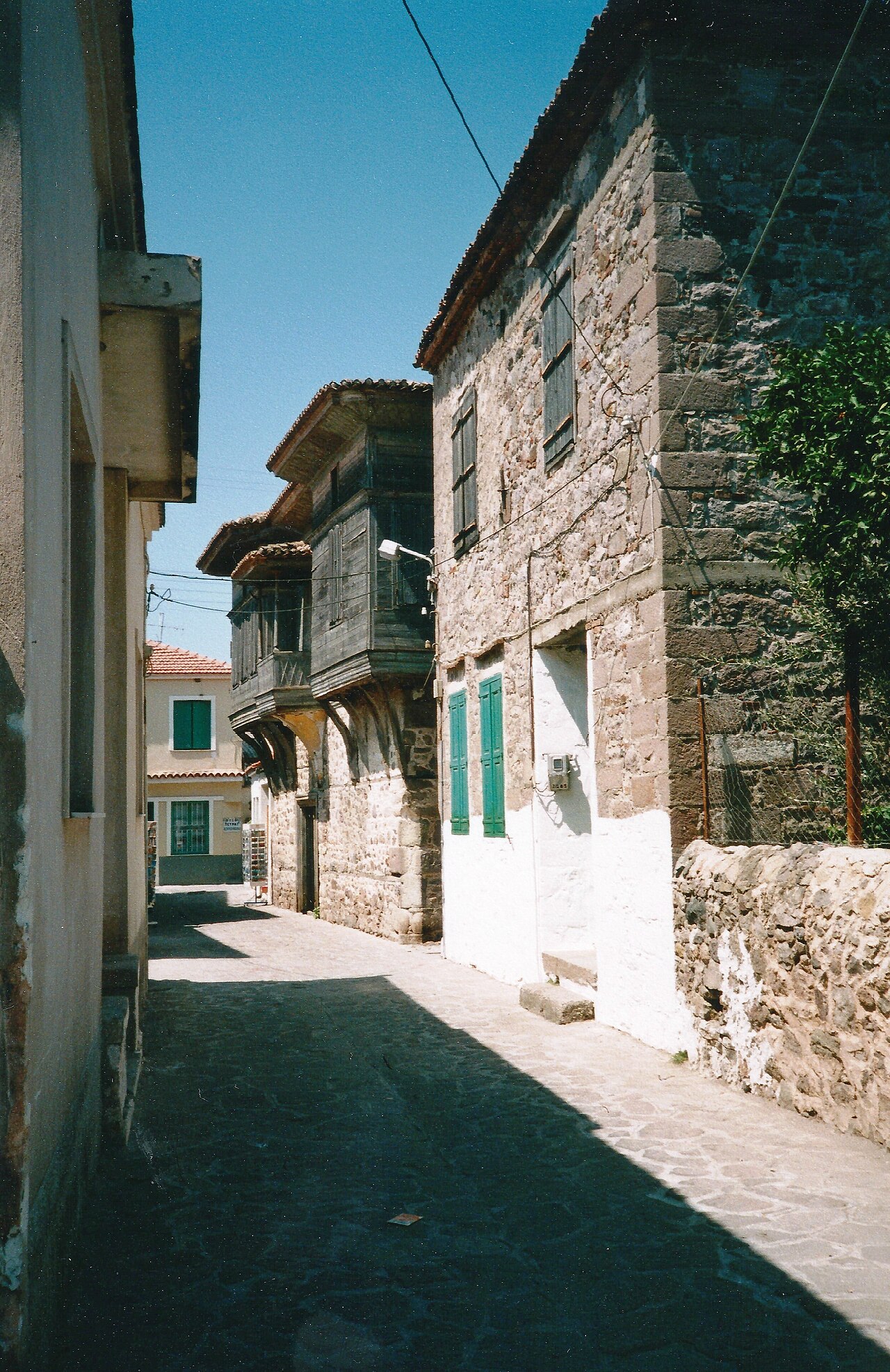
Ancient sites · Petra (north Lesbos)
Vareltzidaina Mansion
A late 18th or early 19th century merchant's house in Petra, used as both a residence and a wine-trading base by the Bardakcoglu family and one of the best surviving examples of secular architecture from late Ottoman Lesbos. The fortress-like stone ground floor was for storage, while the lighter timber-framed upper floor has rooms around a central sofa with carved woodwork, ceiling rosettes and painted landscape murals; it was fully restored in 1999-2000 and is administered by the Ministry of Culture.
Museums · Plomari (south Lesbos)
Varvayannis Ouzo Museum
A museum beside the Varvayannis distilleries in Plomari covering the family's ouzo-making since 1858, when their first alembic was made in Constantinople. Exhibits include that original still, historic bottling equipment and the firm's blue labels, with audio-visual presentations in Greek and English, tastings and a shop.
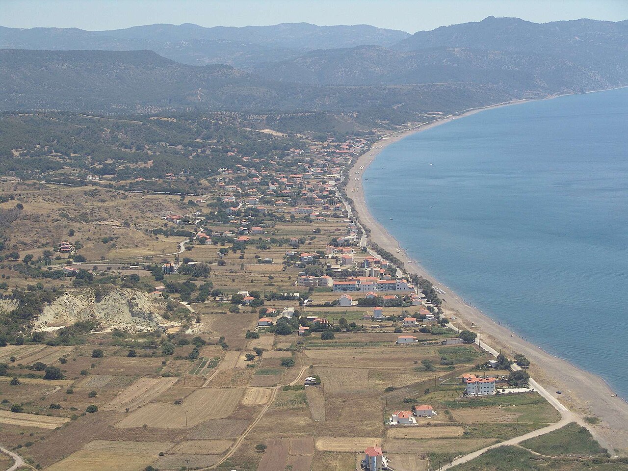
Beaches · Vatera, Polichnitos municipal unit, southern Lesbos
Vatera Beach
Roughly 8 km of sand and fine shingle on the south coast, described by Wikipedia as about 55 km from Mytilene. The shore shelves gently and is backed by low vegetated hills; Chios and Psara are visible offshore. The same stretch is a noted Late Pliocene fossil site — mastodon, stenoid horse and giant tortoise remains were reported here in 1997.
Sea & diving · Vatera, southern Lesbos
Vatera Beach Watersports
Vatera's 8 km of open sand and shallow water is the usual south-coast base for casual beach watersports, and a marina is mapped 4 km west at Skala Polichnitou. Important caveat: no watersports operator at Vatera could be verified in any open dataset or official source — confirm locally in season rather than relying on this entry.
Villages & views · West Lesbos
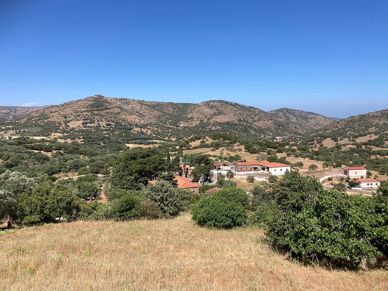
Vatoussa
A stone-built village of tiled roofs and cobbled lanes on the volcanic slopes inside the island's largest caldera, surrounded by oak forest and black pine. Its 19th-century buildings include the Gogos mansion, which houses a folklore museum and an ecclesiastical-Byzantine collection, the Taxiarches church of 1832-33 with vaulted tombs, and the Dormition church of 1850 built entirely of dressed stone.
Practical · Mytilene
Vostaneio General Hospital of Mytilene
The island's general hospital and the only full hospital on Lesbos, at Efstratiou Vostani 48 in Mytilene. Open around the clock; main switchboard +30 22510 57700, appointments 2251021111 / 2251029800. After 21:00 entry is via the Emergency Department entrance on Theofilos Chatzimihail street, which also has the parking access. Reachable by town bus from Sappho Square.
Museums · Papados, Gera (east Lesbos)
Vranas Olive Press and Museum
A steam-powered olive mill at Papados in the Gera district, built in 1887 by Nikolaos Vranas, grandfather of the Nobel laureate poet Odysseas Elytis, and worked for about ninety years until it closed in the early 1970s. The ruined complex was acquired and restored by the cultural organisation Archipelagos and reopened as a museum with its original machinery in place.
Eat & drink · Kampos Plagias, Plomari, southern Lesbos
The World of Ouzo
Visitor centre and museum run by the Isidoros Arvanitis distillery at Plomari. The tour covers Lisvori anise and other botanicals, the working copper stills, the bottling line and a collection of historic distillery artefacts, ending with a tasting. Advance online booking only; groups of up to 12 every 30 minutes.